
Pahrump, Nevada. February 10, 2015
1
Meanwhile in Pahrump: if one Rotweiler is not enough - get four! (small sign reads: "electric fence")
"Turn right, then left, then right, then left." - said Roger on my way out and as you can probably guess I got lost. Despite the headwind and my poor sense of direction I made it to Death Valley.
Or so I thought, I had taken the wrong road and had to go south for about 2 miles across the desert to reach the right track.
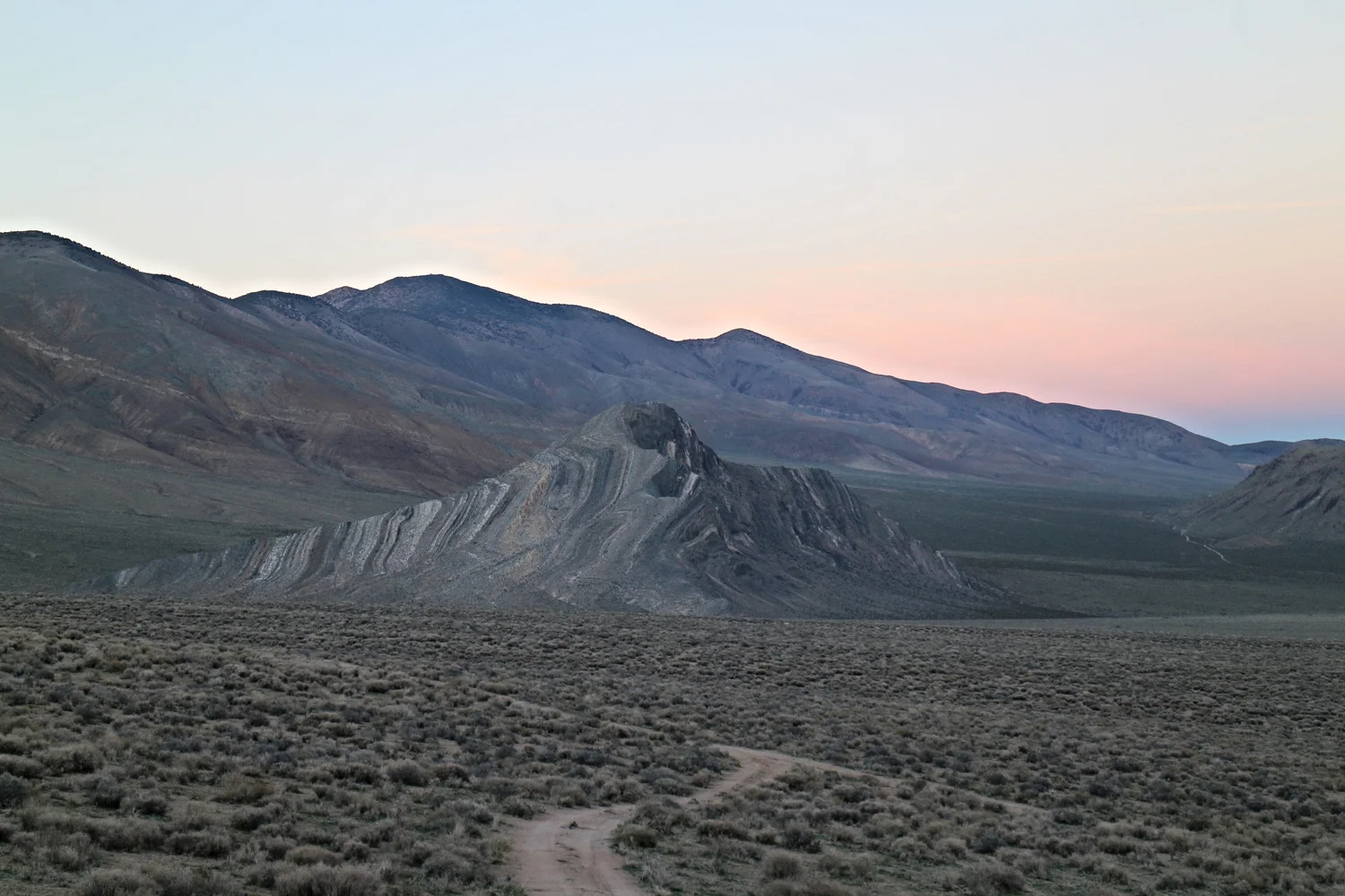
Cutting across the desert
Deadman's Pass
Deadman's pass was a steady low grade incline with sandy surface, desert plants and wide open views. Riding down from the top reminded me of the Great Divide bike route. I thought about heading into Mexico and how boring Baja's paved roads may be, why not enter Mexico in the mountains where there isn't a shortage of logging roads? That thought got interrupted by a break in the rear rack, the L shaped connection was split in two but a wise man once said:
"if you can't fix it with duct tape and zip ties, you can't fix it".
This is one of the most scenic breakdowns I've ever had!
The coyotes woke me up 3 times that night. I really enjoy the sound of their high pitch howl, as opposed to when I heard wolves near me in Montana.
2
I met a couple from California camping beside the road, they have been here for 2 weeks and told me where the good spots in Death Valley are. I quickly took off, otherwise I would probably end up spending 2 weeks here too.
The climb to Dante's view was steep and long but a lot of drivers were cheering me on. At the top I met a motorist from Toronto, a man from Bombay and a cyclist who had gone across USA 30 years ago.
The view from the top was splendid...
...and so was the downhill ride
...all 25 miles of it to the bottom of the basin.
I was at the ranger station wondering where to go next. With the map in front of me, I pointed to a mountain pass on the south side:
"Is this one passable?"
"It should be okay, we never go there. That's the most difficult road in the park. 45 degree grades and boulders, you will need a winch."
I nodded, he didn't know I was on a bike and I didn't want to tell him, he would think I am crazy.
"There is a reason they call it Mangler pass," (actually Mengel)
"Oh, I was just curious"
So curious that I decided to check it out. I bought a gallon of water and 3 overpriced 1L Gatorade bottles, bumping my total to 20L and very very slowly I left the last services for the next, 4 days.
3
This shot of Badwater basin showcases my skills of holding the camera horizontal.
After the vivid colours of Artist's palette in the morning light, I headed into Badwater Basin, the lowest point in North America. All of a sudden some 30 cyclists rolled in, changing this quiet spot with the odd clinking and clanking of 30 sets of cleats as they walked around taking pictures.
I overheard such a genuine conversation between some seniors:
"Is it a motor or a bike?"
"A bike"
"And he goes up and down the hills?"
"Oh my gosh, he must have strong legs."
5 miles down the road I saw a cyclist who must have gotten separated from the pack. He stopped, he wasn't one of the group. After we introduced ourselves and I already forgot his name he told me that he is here driving, biking and hiking.

He later drove up to me to top off my water and gave me some food.
I began my ascent up the rough road, sometimes snaking my way up in granny gear or just pushing my bike. After passing an old mine I reached a campground at some abandoned houses. Then the biggest tragedy of all befell me: I lost the GoPro charging cable, what will I do now??
4
While negotiating some tennis ball+ sized rocks on the road a pickup approached. I wondered how crazy you need to be to be driving on this road. They told me to stop and see them up the road and about an hour later I saw their truck parked beside a cabin but had to deal with some wild burros first!
Sarah was from Connecticut and Jason from Louisiana, with them was their two year old who had amazing talent for finding random pieces of glass on the ground, in the middle of nowhere! Few hours later I realized that I wont be going anywhere and decided to take a rest day here at Geologist's cabin. They not only had a charging cable for my gopro but offered me the camera that came with it.
Striped Butte with the new camera
To the cabin they brought a flag which read: "Live, Love and Liberty"
5
"Carl Mengel was a miner in Death Valley. He lost a leg in a mining accident, and continued to mine. His ashes and prosthetic leg are buried on top of Mengel Pass." - says Google
After the cabin, the road deteriorated, I pushed my bike over Mengel pass. The long weekend brought many drivers here, including Mike, a Chinese around the world expedition (stranded here, waiting for repair), a lot of motorcyclists and jeep clubs. The road was rough but downhill and contrary to what I thought, all drivers were slowing down to greet me.
Mike's jeep and Deadhorse the bike!
Abandoned mines, living quarters and machinery surrounded the road. These roads were made some 50-70 years ago when the area was being mined. Mules which escaped learned to live off the land and remained here ever since, wild. Even now there is some strictly regulated mining in the area surrounding the national park (not with mules, but huge machinery!).
Below is a short video of one of the hardest parts:
Around the world trip halted temporarily at Goler Wash road.
A 4x4 in its natural habitat. Those things would look so silly on the highway!
The road to Panamint Valley
Few hours later I arrived at Ballarat, what I expected to be a ghost town, was full of people and I was greeted with an ice cold soda and a beer. A jeep club surrounded me, asking questions and wondering why on earth was I pedaling a bike on these roads. My moment of glory was over when they all rushed out to help somebody who broke down in the mountains.
Horse vs Mule? There was a wagon race from here to Los Angeles won by the mules. There was cheating though - the wagons were collapsible and were taken apart when going through the mountains. Too bad there wasn't any reality TV back then!
No 5-star hotels here. This is where Rock Novak, the caretaker lives.
Charles Manson's truck. Known for the horrifying murders that took place at Baker Ranch here in Death Valley. More horrifying to me is driving this truck up those roads in the 60s.
Have you ever seen one of those side-car motorcycles? The ones with a dog in it? Rusty is one of those dogs, and I met his owner Bob. He told me more of the story of the mining town of Ballarat and how he is working on making a documentary about it. The ghost town itself was home to an army of RV's for the weekend, a small museum and its caretaker and plenty of destroyed or barely standing buildings.
Rusty the motorcycle dog & friends. Photo: Bob
6
After finally finding pavement I met another cyclist who had hiked the PCT and told me about his plan to ride up Tioga pass in Yosemite. Wouldn't that be a cool ride? Leave the desert for some snow. The idea of that in the heat of Death Valley sounded very appealing.
From sea level to a mountain pass is no joke. As I crawled my way up the hill, the family from Geologist cabin stopped by. Jason stepped out of the car and looked down the long windy road.
"You crazy crazy crazy kid."
It was a long hill...
Atop of the hill I took the Saline Valley road, the couple I met on my second day suggested I check out the hotsprings there, and it was on the way to Yosemite. Oh yeah! That's where I'm going next.
Knowing you can stop and put your tent anywhere, for me is one of the best things about the backroads. Watching the sunset, sleeping under the stars and listening to the coyotes. I Love Death Valley!
7
While rattling down the rough road a pickup stopped, the woman warned me about the road ahead and told me that it's okay if I get a lift.
"It takes 4 hours by car," She said. 4 hours. for 40 miles.
Cow and two calfs were on the narrow road ahead of me. They kept running ahead and away from me and while I enjoyed the company I was worried about cars hitting them.
After some 20 minutes I finally overtook them on a flatter stretch.
So cute! Even though he is lifting his tail to take a poop.
"You're all set? I don't want to leave you here to die." said the tow truck driver.
To my surprise the van in the back actually HAD PEOPLE IN IT.
After South pass things went downhill. Literally and figuratively. The rocks were not the size of tennis balls, it was more like melons. I took a note to carry a melon for comparison purposes next time I go down a rough road. The ruts were everywhere and they were bad, there was no good line. At times I just let the brakes go and bolted down, mumbling apologies to the bike and wondering what will break next.
Words or pictures can't describe this road, here is a short clip:
It was 4pm and I was near the turn off for the hot springs. No way I can make it there before dark. A pickup pulled over and I told him that I wanted to skip the hot springs: it's hard to justify 14-mile detour on such a bad road. He offered me a ride and after seeing that I've broken another bolt on the rear rack we loaded up Deadhorse in the pickup and took off.
The hot springs were great, the food was delicious and the company was amazing. Cody and his friends got together from all around the USA to spend the weekend here. When I asked him how the hotsprings can be in such a great condition he said:
"We call it the 60-mile bullshit buffer. Everyone who drives through that road is well prepared and does their part in keeping the place clean."
8
After replacing the broken bolt, the only alternative which involved me cycling was to have my new friends stash my gear at the pavement, some 40 miles ahead.
Below, a song to send me on my way
Wild burros here have insatiable appetite for paper and sweets. Wrecking camps in the valley and not even touching the carrots. I literally pulled out a Hershey chocolate bar from the mouth of one of them.
"The Source" for the hotsprings
One of the pools
The road... honestly made the logging roads of the great divide feel like a bikepath by the lake. The other detail I missed is that I am going up 7300ft from near sea level, add the other hills and thats 7680ft (2341m) of climbing.
My gear will be at the pavement beside the sign, I was also taking a leap of faith that nobody will take it. The approaching dark was a problem too. Just as the sky started to turn red and purple, a military jet flew by near the top of a hill, I stood there speechless, looking at the plane and listening to the fading thunder.
As if its a joke, i spent the last 2 miles pushing my bike up a steep hill in the dark. I found my gear intact at the sign, next to it somebody left a beer, chips and gatorade.
Lime-cucumber gatrade. Cucumber... I didn't know they make that stuff.
Coming into Death Valley and looking at the blank spots on the map, I expected to explore remote areas and go for days without meeting anybody. Instead, I spent almost every day in great company, people fed me and gave me food (I actually have more food now than when I started in Pahrump) and treated me like family. The desert was full of life from bugs and lizards running around to coyotes and paper-eating Burros. And the Saline Valley hot springs... I will be back one day!
I looked out my tent in the morning to see the Sierra Nevada range. At almost 10 000ft, Tioga pass is the highest in California. There will be snow but how much?