Take Me Home Country Roads (Winter is here)

November 2020, Quesnel, BC

The bike had a set of studded tires which I would find out are absolutely necessary on the frosty winter roads ahead. Since temperature would be great for any foods, I stocked up on some of the nice pre-made soups at Safeway

Even though it was the only bike shop in town, the cycle logic would have been my first choice! Great service and they were totally cool with trading in my old tires

you get a soup and your get a soup!! I think I ended up with 7 of the pouches, all tucked in non-crushable storage locations on my bike (mostly in the frame bag)

I like how they add the “slippery when wet” sign just in case someone falls, forget about all the chair legs protruding in the maze.

I didn’t have to bike far to be thankful for the new studded tires…

but it all pales in comparison

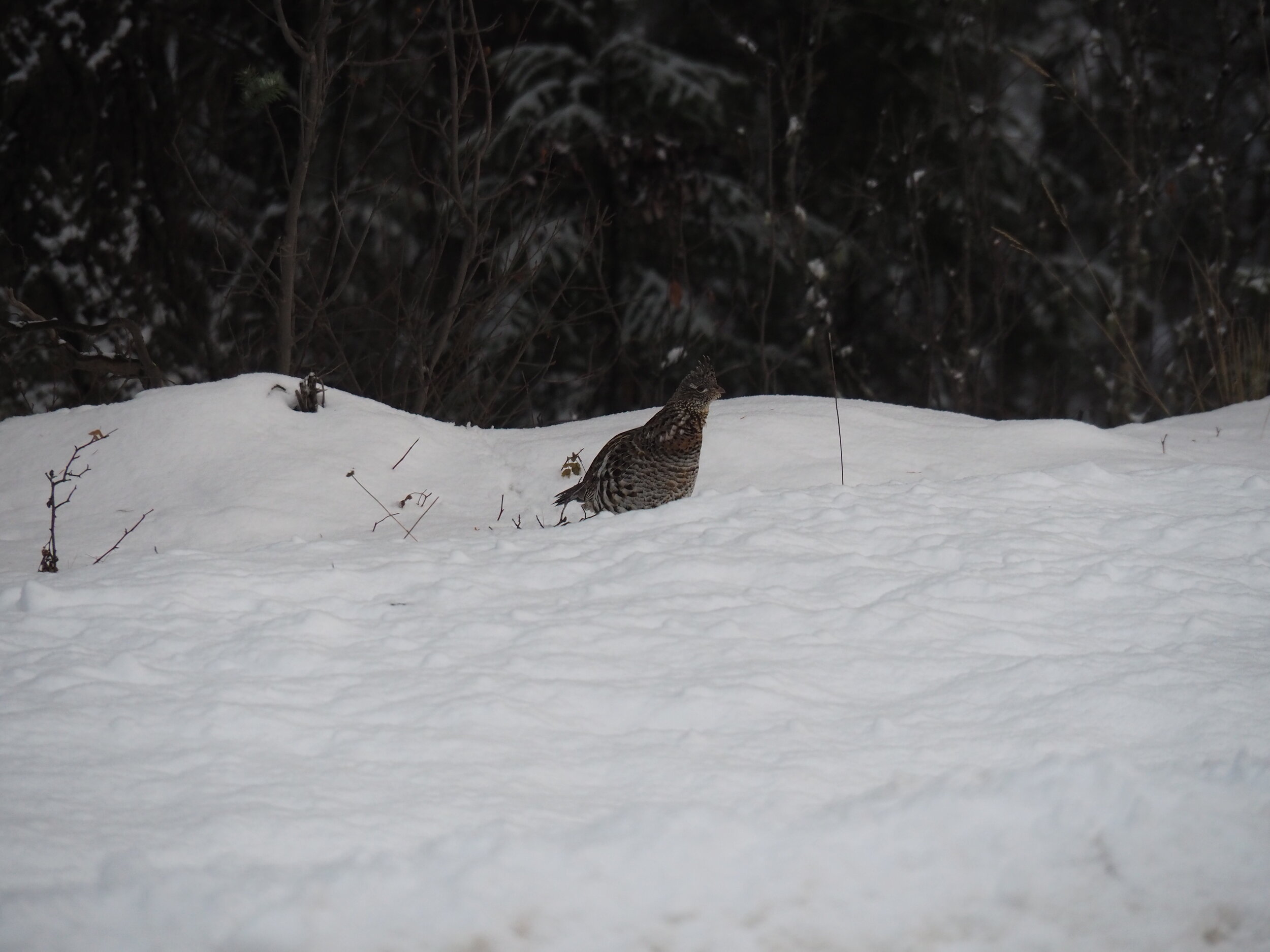
The road was small but well used, plenty of beer cans and grouse on the shoulder, I still think this is much safer than going on the main highways - especially in winter.

I set up at a nice turn off and happily used a dustpan that I bought on the way out of town to clear my camping spot. Fresh out of town I still had boiling water in all my thermoses and a sandwich or two. It’s really nice to be biking in a fridge!

I went to adjust something but my Canadian Tire multitool wasn’t up to the task

Canadian Tire has really went downhill over the last couple of years

A logging truck snuck up on me but it was all good, they really do drive slow on these roads. Some horses took a great interest in me but they seemed just as odd as I did to them.

some great cookies thanks to Bill and Anita from Quesnel

I barely remember riding through the area one August, everything was so green. Now there is the gloom of the winter and that thin layer of cloud that always sticks around. Now even in summer things go so quickly from the spring melt to the fire season. The winter is a good time to be a cow. with all cattle guards snowed in it is only those great Canadian marshmallows that keep these beasts in check and on their farms.

but it was obvious that these aren’t those grass-fed cows that A&W is raving about. They mostly subsist on a diet of giant marshmallows over the winter

A farmdog, Dot followed me around for a bit but his humans assured me they will pick him up if he strays too far. He didn’t but he made sure I made it safely to the other end of the farm.

Drinking and driving is like playing slots machine!

beer

beer

deer, it was an accident.

deer

The days are short and the moment the sun goes away the temperature plummets, often making me wonder if I should have taken the last decent camp spot.

This was the only photo I got of the camp, just out of sight of the road so nobody stops in the middle of the night to ask if you are okay.

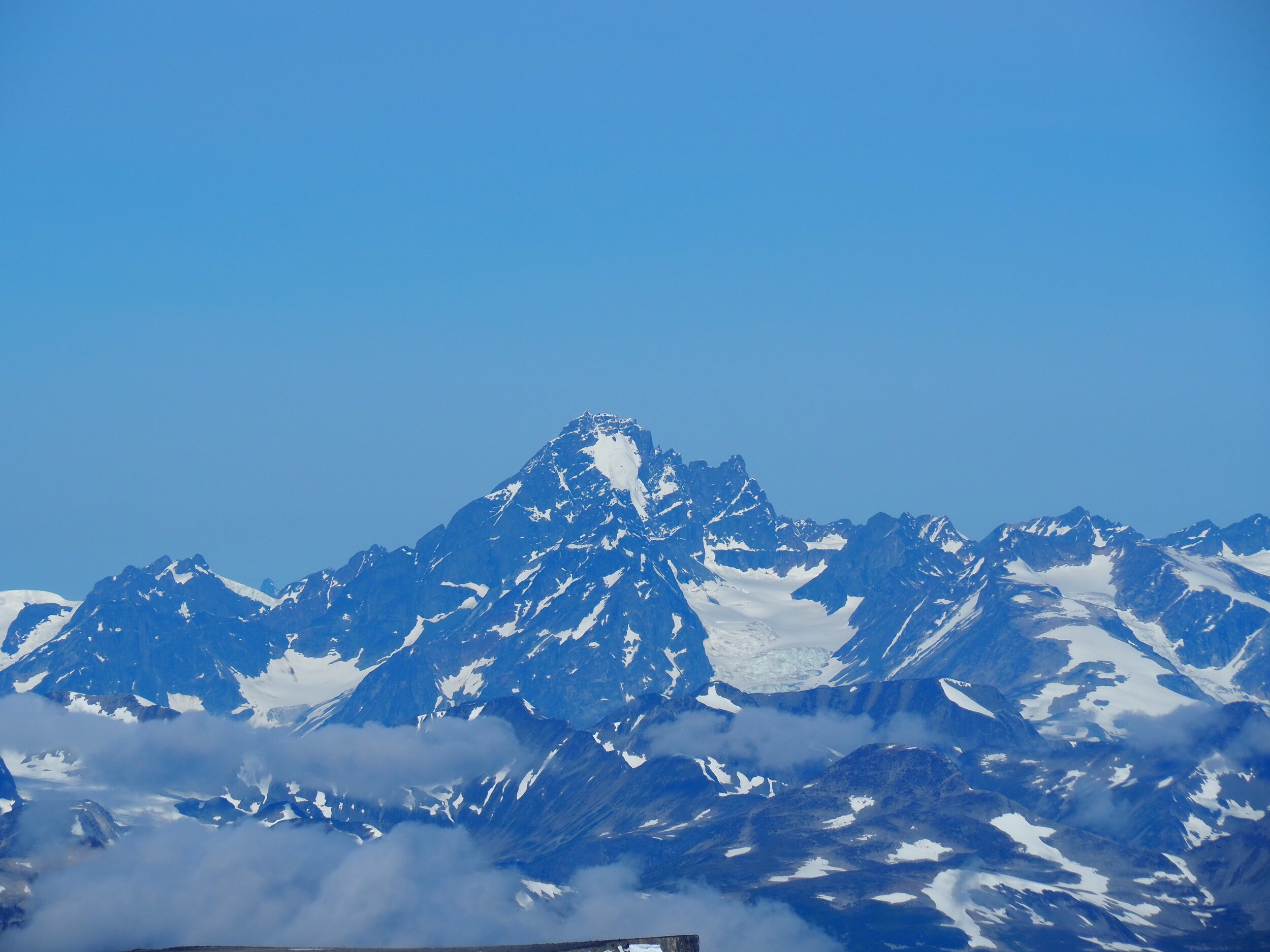
The morning was gloomy and that thin cloud cover never lifted enough to give the landscape some color. The Fraser Canyons runs quite a ways and I will be following that all the way to Cache Creek, just on the less developed west side.

The grader operator came to a full stop, engine off - socially distant chat. He assured me that the road was plowed to and past Farewell Canyon and this was great news, a detour to Williams lake would have taken at least a day along with quite a bit of climbing.

camp was fairly uneventful, just off the road but out of sight. No fire yet as I am still fresh from town (eventhough this is day 3) I still got some of those amazing soup pouches which I think are making a big difference.

The Broccoli Incident

The morning was cold and crisp as usual, it looked like I may see the sun today

I got past a nice ranch but not before wrecking havoc among the cows brave enough to remain on the road. And boy you need to see the video when that makes it on youtube, I got my studded tires but cows… they don’t have studs on their hooves!

The sun eventually broke through and it was a very nice day to be out on a bike

I had a brief section of the Bella Coola highway and was glad to get away from all the traffic, slush and that annoying sound that studded tires make on pavement. I don’t think I want to ride pavement again.

The moon was out I was happy to be riding into the more open areas along the Farewell Canyon FSR

by the time I was done with the moon I was almost at the top and ready to go into Farewell Canyon and opted for a camp beside the road.

the fading light brings that nice alpine glow and any smudges and specks of dust on the camera lens

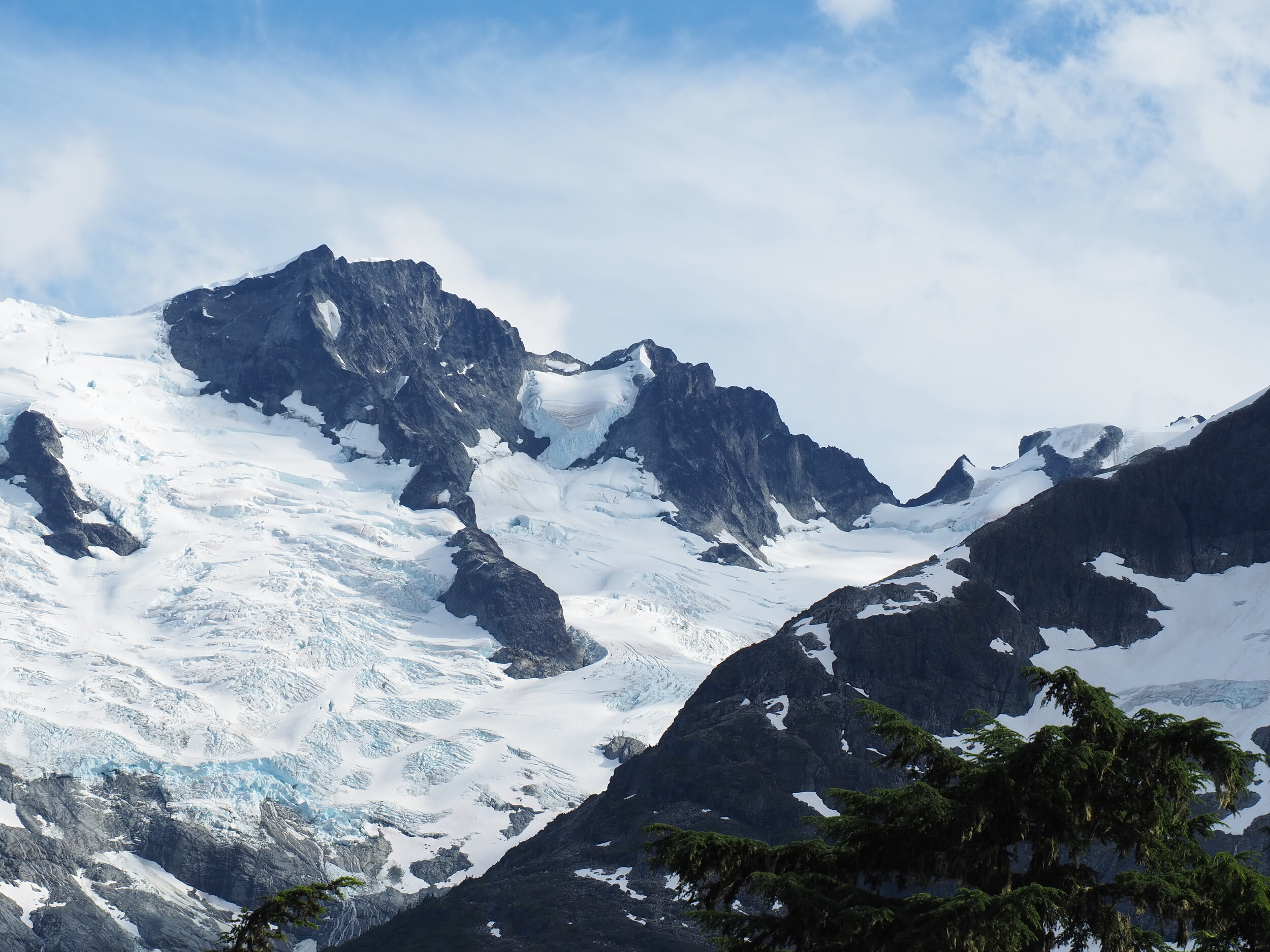
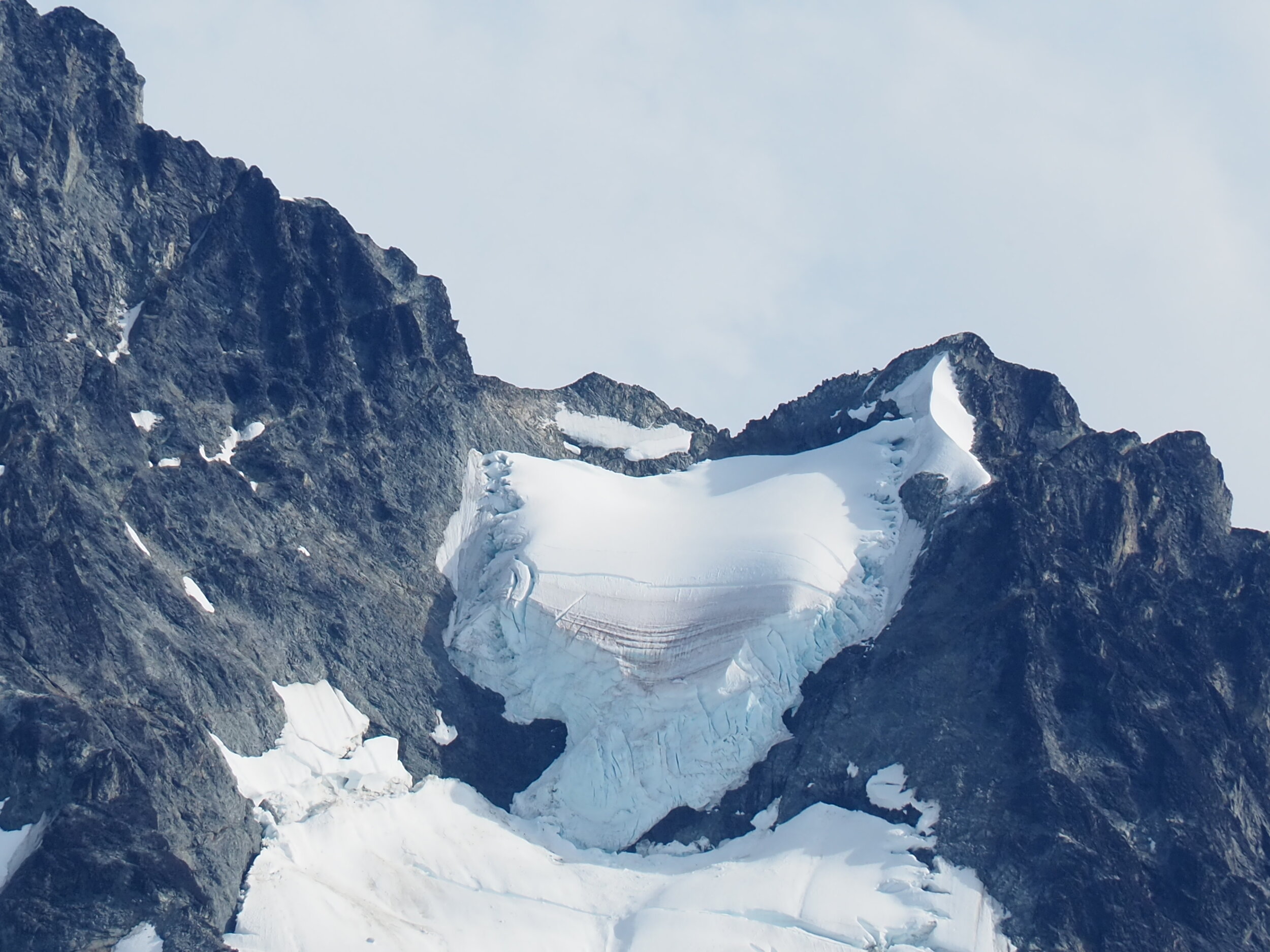
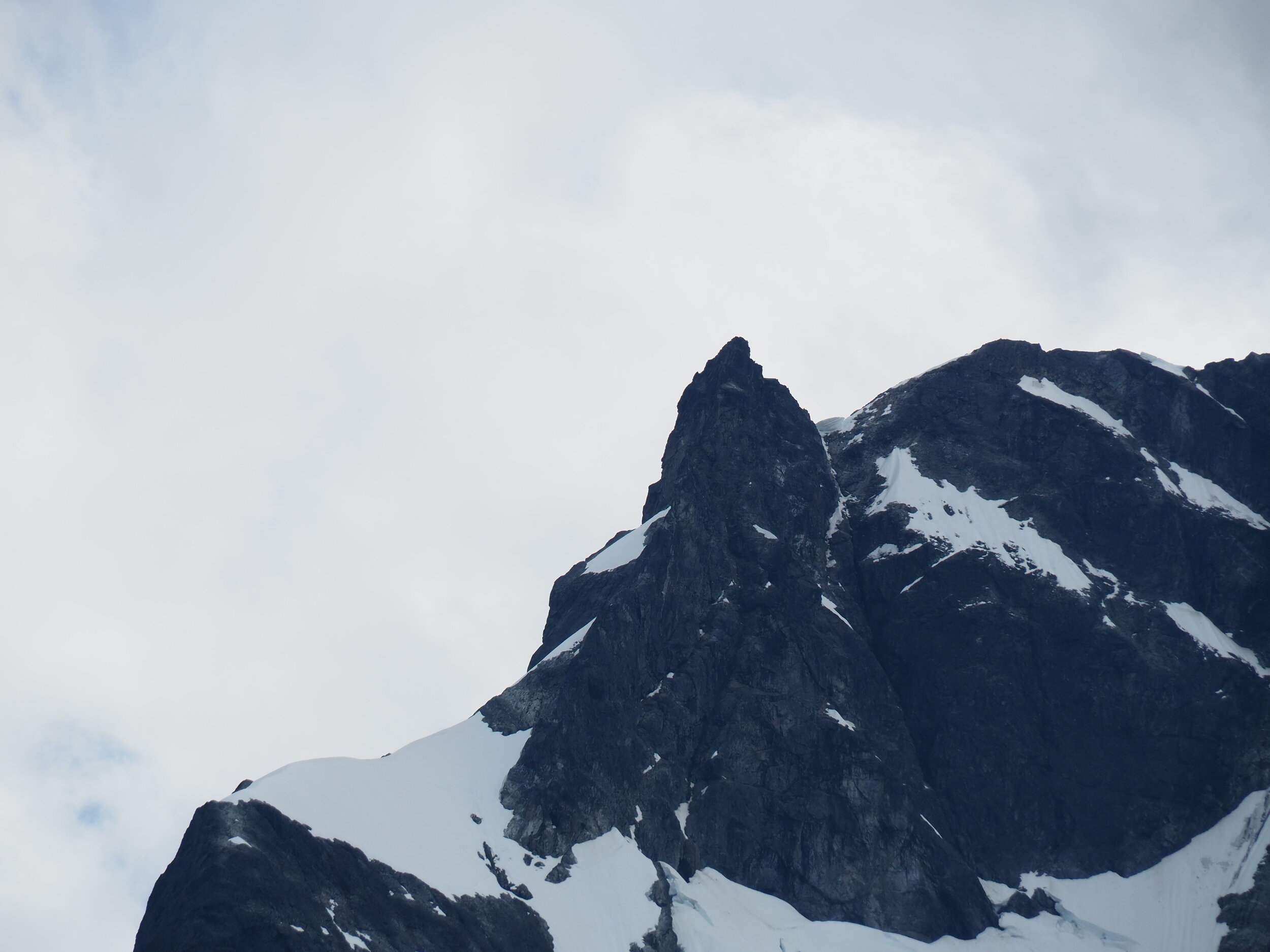
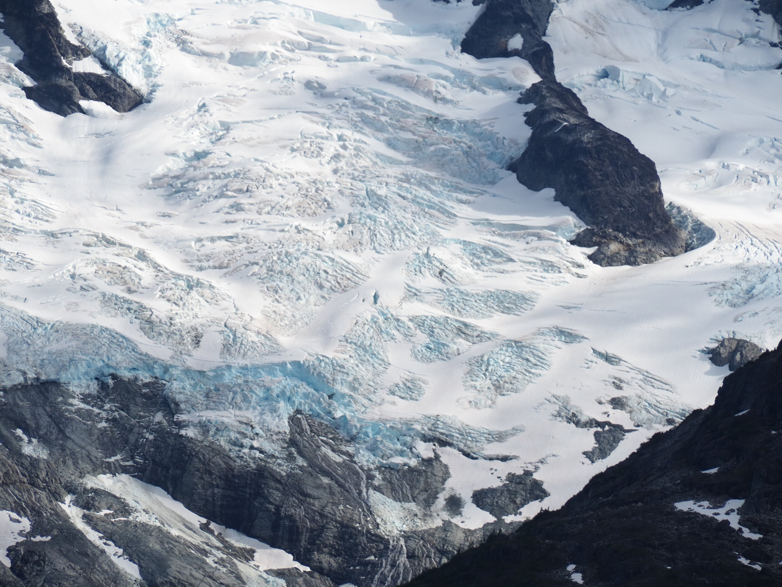
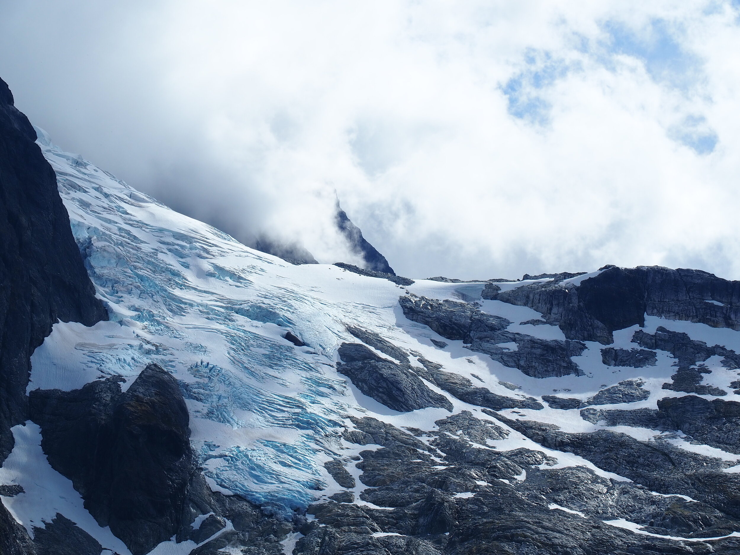
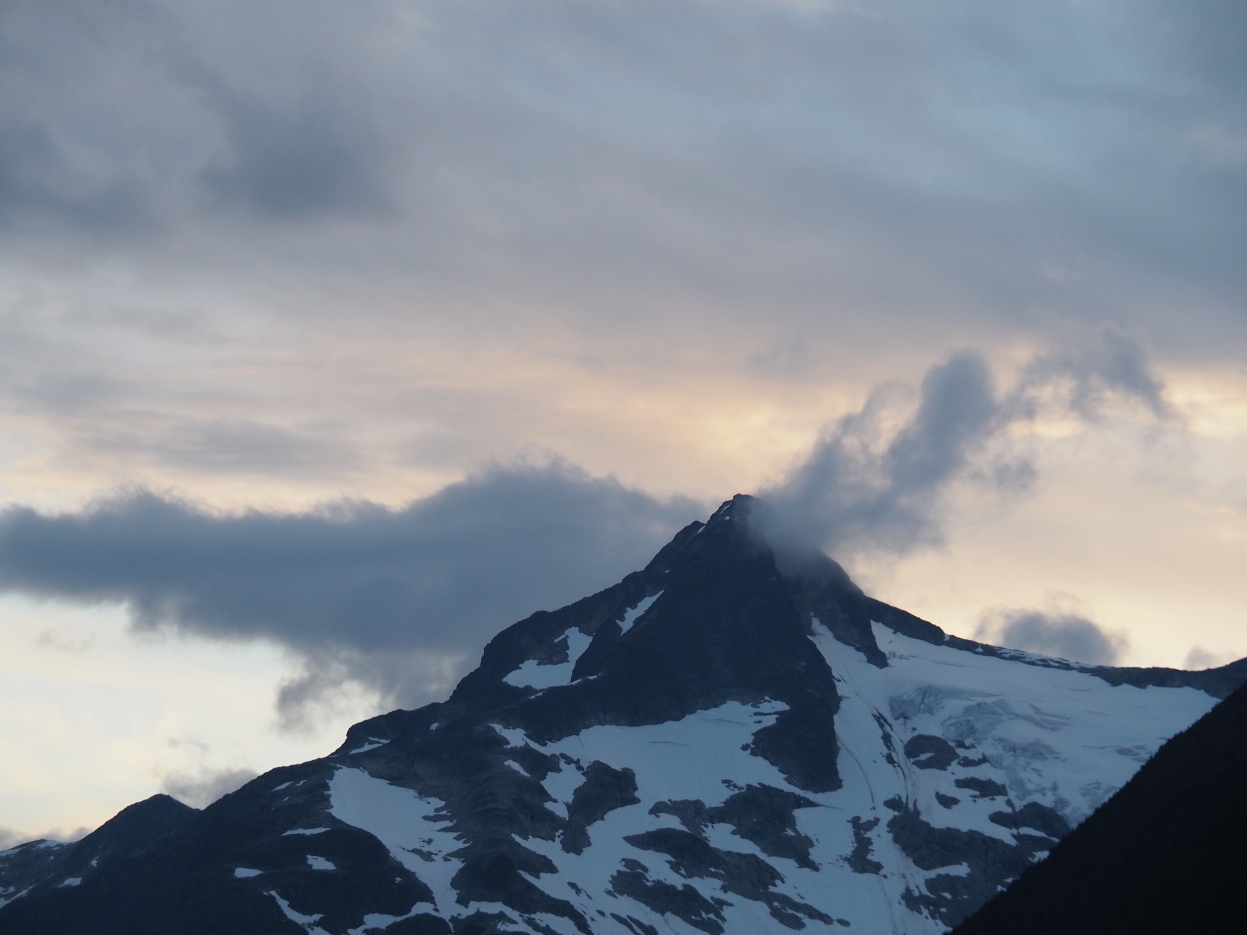
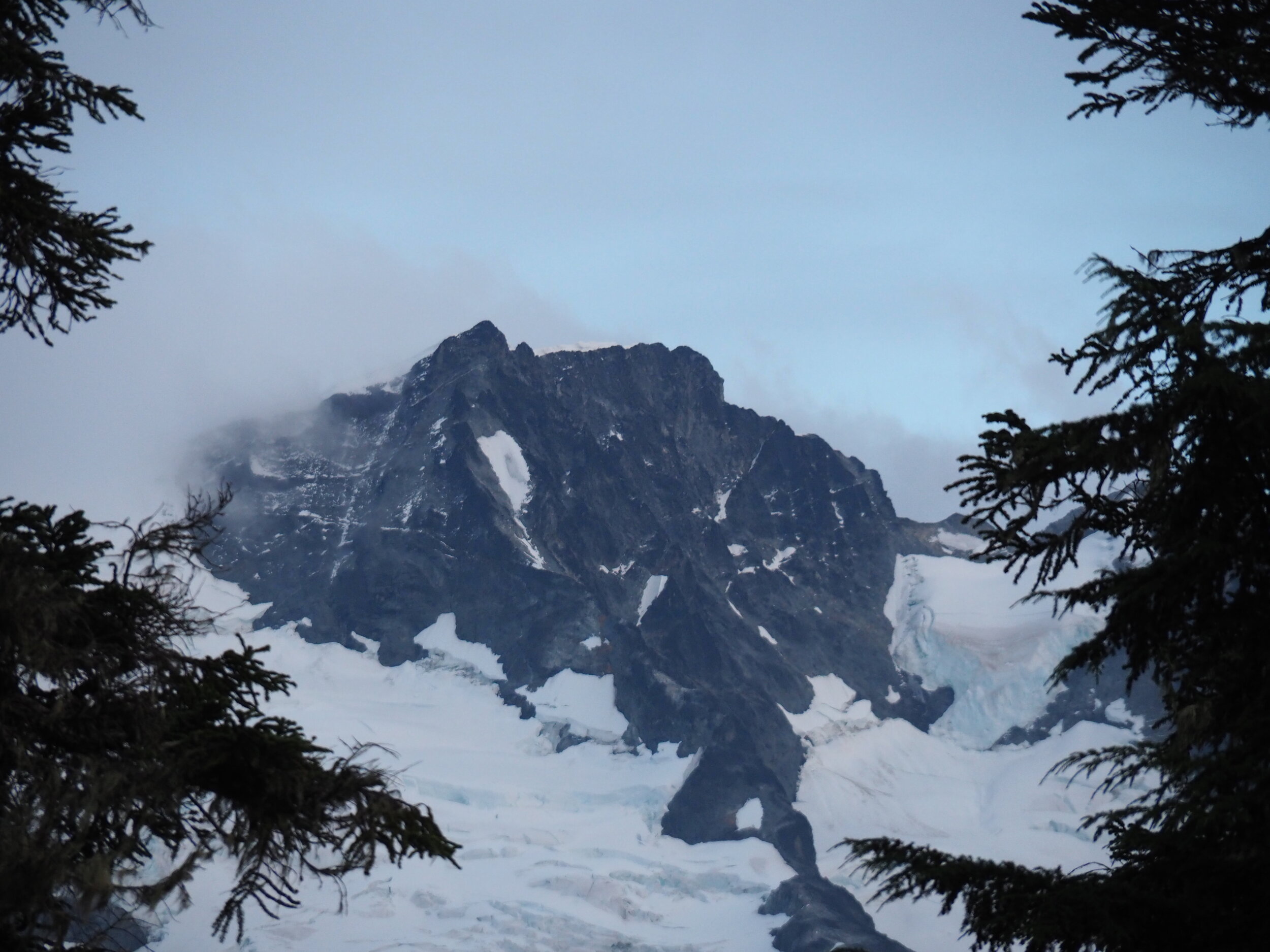
The good thing about having a big descend is that I can throw on all the winter gear on. I had big expectations for the Farewell Canyon, it was supposed to be the highlight of the ride so far but it was very empty, gloomy and void of all traffic. My last ride here went like this: https://youtu.be/srBl5AjBgFU

this could make an excellent waterslide someday…

The way up was half riding, half walking. Walking when I got too warm and riding over the icy sections that I simply couldn’t push my bike up.

Farewell, Farewell Canyon

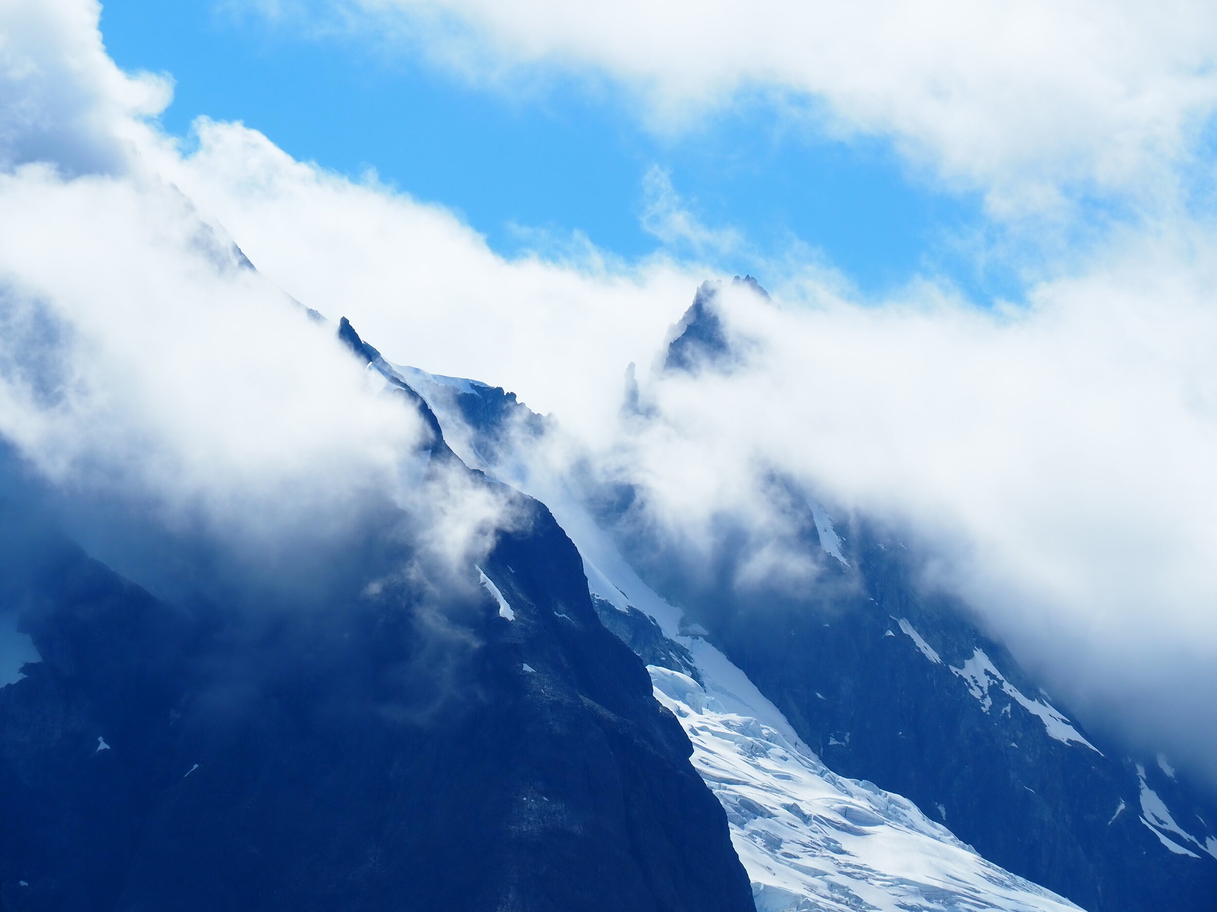
At one point I dropped the camera and while I wouldn’t find out the issue until the end of the winter when I look through those photos there is some odd focusing/background blur going on.

not sure what exactly happened to the camera… but i like it

I caught a sunny break on the top of the hill and thought its a good time to be out… unless you are a 4 point + buck

there’s one hanging right behind the orange truck. I know all the bears are probably sleeping but I dont know if they should leave it unattended like that.

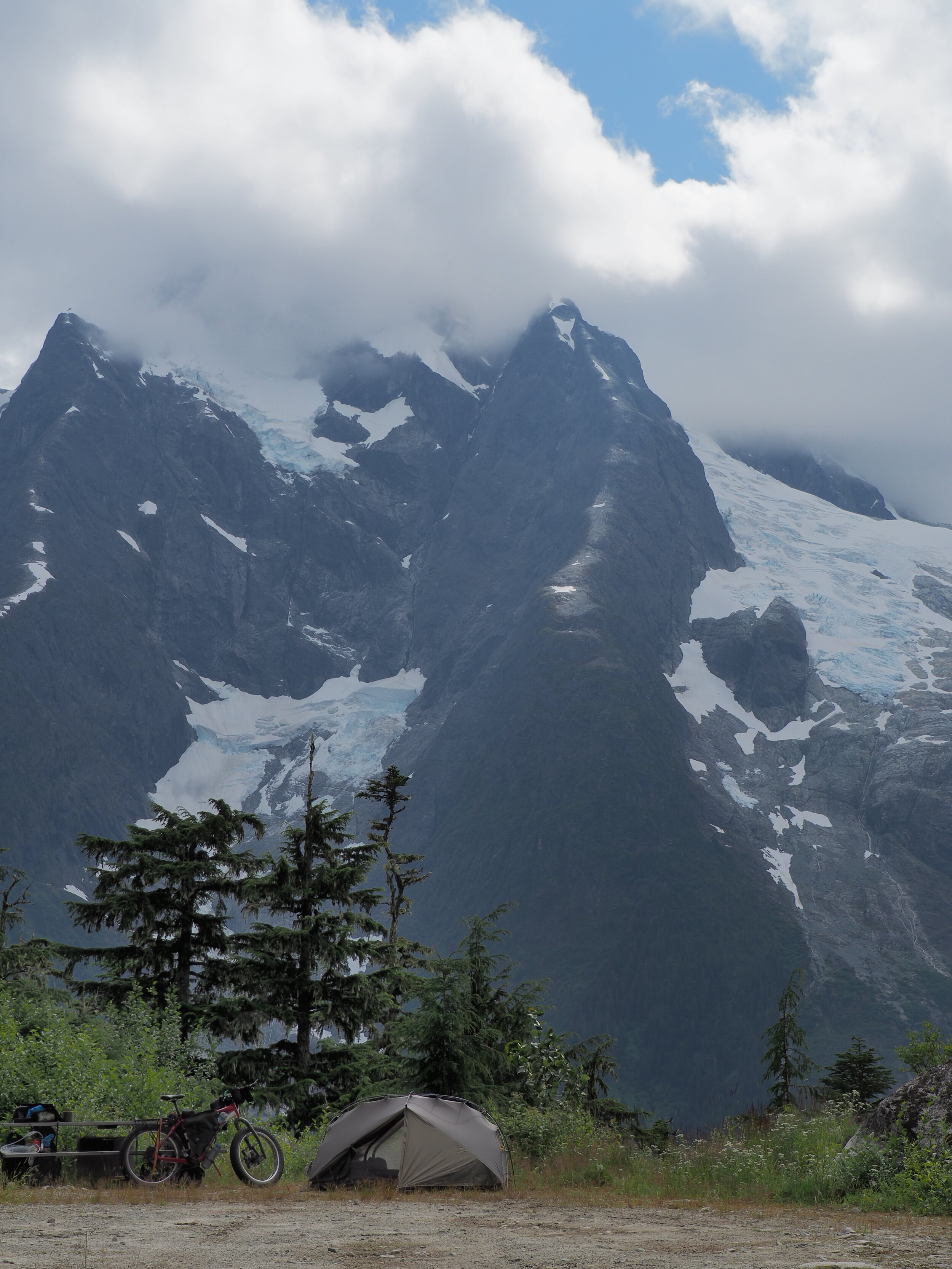
It was day 6 from the last resupply and the cold was starting to wear on me. I found a nice snow-free spot and plenty of firewood around.

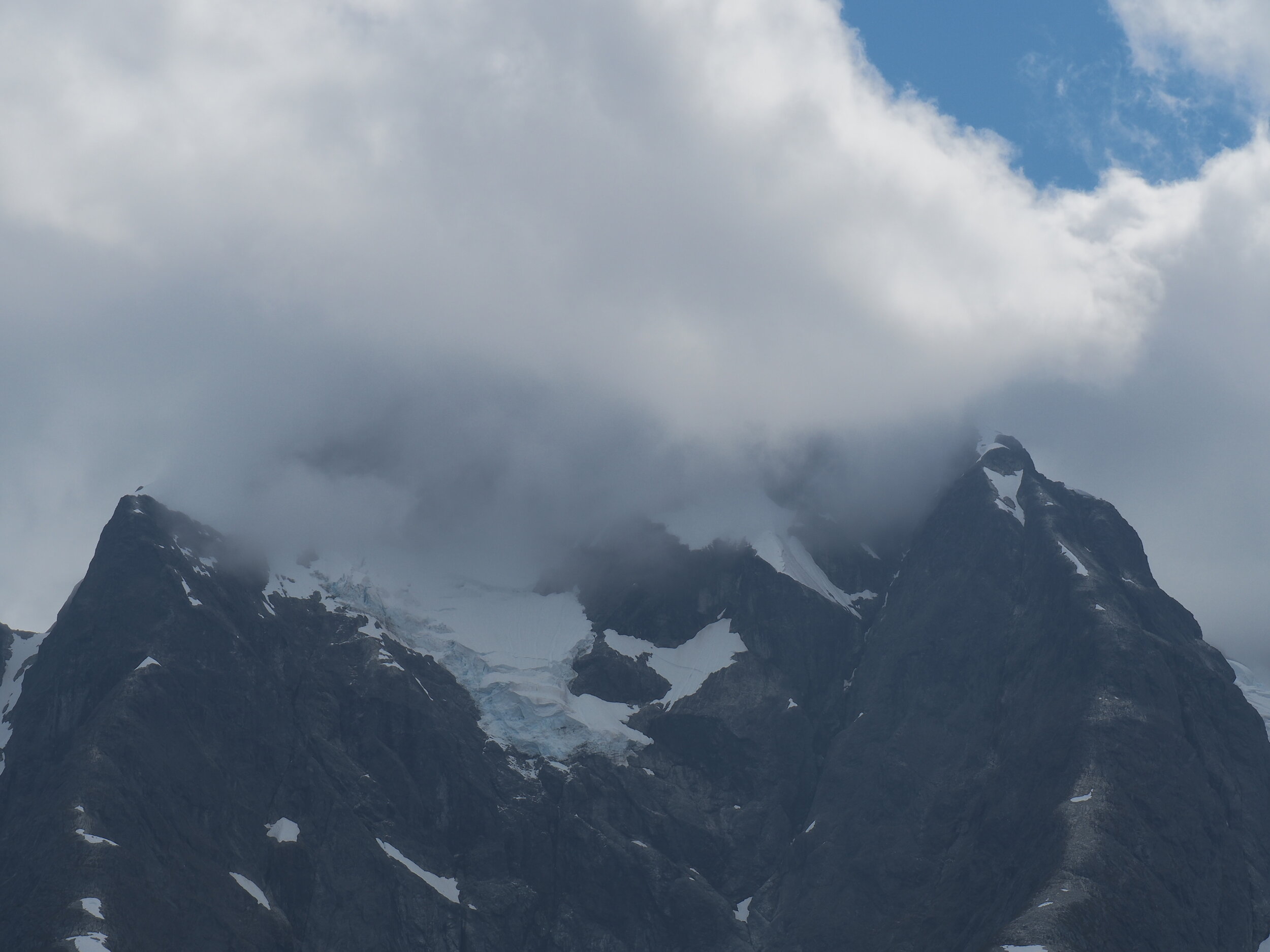
At this point the camera is focusing on what it wants to but some of these shots turn out really cool.

too afraid of how much snow may have accumulated on the 3100 I opted for a more direct route to Gang Ranch, it seemed that somebody drove up in the morning and even without the fresh track - the last car tracks were only few days old.

look at all these premium logs!

It was so cold and crisp that the Gopro 8 batteries were dying like…. hmm can’t think of anything here. A dime a dozen? I had foolishly thought I can shoot the winter episodes in 4k. that won’t work unless you got some serious solar / battery packs. I went back to 1080p a long time ago but it may just be that stabilization that kills it. Often you can jump-charge them back to what they were but you need to warm up both the camera and the battery.

I always had my eyes on the far distance… while still being glad for having two fresh tracks to follow

Eventually the snowpack got lighter and icyer..

and then Mud

There was no escape, nothing. just Mud.

I can still hear the scratching of the rocks and muck against any and all carbon parts and the words of my friend Chris (Elevation Wheelworks, CO) who said “it feels odd packing the bike so nicely, knowing what you will put it through”. His friend Brad from SRAM had hooked me up with a drivetrain and then some.

that mud is gonna stick around for a while…

I topped off some mediocre well water from Gangranch (to be boiled - regardless if its ok or not), I asked someone if I can recharge my gear for a bit and took a good hour by the big barn to get just enough juice into the drone and cameras to make it over the next few days.

I still had to warm up anything I was charging for a little bit, otherwise it just wont go.

I even splurged a bit of warm water to get that mud off the chain, but it was clear that I won’t be pedaling today…. or likely tomorrow when all that muck freezes

I found one spot, just one spot that seemed almost dry enough to set up camp. There was no way I was sleeping in the mud

I was right at the junction with Gang Ranch and The Empire Valley…. the summer map shows a mine way, way up into the mountains and I really wondered if I will ever make it up there

going over the Fraser is always a big deal. This is one of the most well videographed bridges in the SEE THE WORLD series.

I spent a bit of time and some of my last remaining water + snow melt to get the chain… clean enough to pedal on the flat-ish sections

looks like we got the same wheelsize

But the Fraser just went on, it would be so much quicker to be on the water. (preferably not on a packraft with all this ice floating around)

all of a sudden there was a whole bunch of mooing and mooing, I was nearing the ranches on the east side of the Fraser

bad place to be a pedestrian, good thing I have my bike

Then I rode down to all the cacophony to ask for some water and I was recruited into holding the line. It took 3 humans a kid and few dogs to keep the cows contained.. and under control. I got all my thermoses full of boiling water and some great spring water as well (anything is better than the Gang-Ranch well water!)

Looking back at Rosewood or Dog Creek, no stores or anything and I wouldn’t have stopped either way due to covid

The ride up was nice and cool enough to pedal everything. The chain was working okay given the circumstances and I was able to pedal up with ease.

There was just the right amount of sunshine in the evening to bring out the nice colors of the rocks here. I’ve ridden this road twice - once up and once down and I don’t remember seeing this!

I was in touch via InReach with Darren from Prince George about the possibility of taking the Big Bar ferry and while it was closed, it is likely the cable car is still open.

The one thing Darren mentioned is a lookout with a stove and although I hadn’t planned to go there it was very close and right about now a night or two with a stove sounded great.

Over the last few nights I have really wondered how long have I really gone without indoor heating on my travels and its not more than 4-5 days. Not even the ice roads, the winter ride on the GDMBR or going through the southwest in the middle of winter had such long stretches. With covid accepting any invite was off the table, there wasn’t even a table - I haven’t been within 2m of anybody in the last 9 days

Snow wasn’t much of a problem, there was a whole lot less of it around and south of Williams Lake. The top looked okay from below as well. Having had a taste of fresh water and with stream access being quite dangerous/slippery I asked at a house for some water, boiling water. I got both my thermoses full and then some. If Bonnie Henry (BC provincial health officer) was to see this interaction it would surely get 2 thumbs up.

Jesmond Lookout

It started snowing and blowing but I made sure to take that coveted lunch break. A cup of warm noodles and few spoonfulls of hot chocolate can do wonders. I left Quesnel with 2x500g of nestle hot chocolate bags and I was well through my second one.

it was a bit of a slog near the top. Just enough wind to get some snow blowing for the camera and barely a 200m section that was tough.

the final bit I did with backpack and then I came for the bike later.

and that moon from several days ago was just about to come back

but more about the sunrise and the lookout in the next post

here is a little video including parts of this winter ride with a cover of Country Roads by Driftwood Holly ( whom I met in EP2 )

The Bella Coola Valley

August 2020

With the ferry still 10 days away I will have time to see all these little roads leading off from the Bella Coola valley and who knows, maybe even a hot shower at some point. The first on the list was Odeguard Falls and Purgatory Lookout.

Camping is always easy in Canada, pick a logging road and go until the first flat pullout.

The road, like many roads in the area had a “road closed” sign, indicating a washout further along but few locals told me that it was in okay condition. It was a rather gloomy day with few sunny breaks and rain from time to time. Occasionally the clouds broke to offer a view to the glaciers and snowcapped peaks above.

The bridge in question was there but it was just difficult to get to it.

There was active logging partway up the road but no logging trucks in sight, which is a good thing. Some of the tree stumps along the road were enormous!

There was the distant road of Odeguard Waterfalls and the closer and more loud river going down the valley. Kind of like camping near the highway although the noise was more consistent.

The steepness of the valley was difficult to capture, even with the wide gopro lenses.

after the road leveled out I could see my next stop: Purgatory Lookout.

My initial plan was to continue down the valley to the end of the road on the coast and if I did make it there I was ready to try and find a boat ride over but the road was way too overgrown. I could see down the valley where the road used to be but it has been too long since it had been driven. Even on foot, without a bike it would be a big bushwalk

Then I decided it was time to take few days off, waiting for the ferry - Bella Coola style. On the second day I almost saw the Purgatory Ridge and did some maintenance, on the third day it was clear and on the 4th day it rained cats and dogs all day.

I backtracked a bit to an old trail leading to a ridge. It continued on the map but that seemed like a mountaineering route. It was a bit bicycle unfriendly and eventually I hid the bike behind a tree, taking a note of where it was via GPS and few photos, then continued on foot.

The trail was great for walking and the views were amazing.

Further up you could start seeing the surrounding mountains, water falls from glacier to glacier and the weather was surprisingly nice

this was camping at the edge of the world and I somehow wished that I prepared for a longer hike but one night will have to do. I remember once asking someone why people don’t camp on mountain tops and was told that there could be electric storms and boy did I have an exciting night when the lightning started. At some point I wondered if I should pack up and go but ended up staying in my tent and surviving to tell the story.

The walk back was easier but quite wet and once I got on the bike I was happy to be riding again. Odeguard falls got some sun through the clouds and I splurged on the best campground in Hagensborg, complete with a hot shower and a power outlet to recharge the batteries (

The ride through the valley was nice while playing tag with the rain and deciding what I can do for the next 3 days before the 4am ferry departure. I made a note of where the ferry terminal was as I would be riding to it in the dark (it would be hard to miss though).

Going up Clayton falls started out nice but soon the rain took over. It was a tough call but I think I got enough nice coffee and treats sent from my friends in Cranbrook to make all the rain okay.

but somehow the rain and the clouds made the coastal mountains that much more interesting, showing only bits and pieces of the jagged peaks and glaciers in the distance and the turquoise blue waters of the fjords

It cleared out for a bit and then it was gone. Just rain for my last day. I was hoping to ride down to a big cedar tree and then backtrack before taking the ferry but it didn’t seem like a good idea.

It luckily stopped overnight and for the ferry boarding. The first one was a small ferry going from Bella Coola to Bella Bella, with a layover at Shearwater. There was a layover at Ocean Falls where we could see a big dam and we were all fashionably late to the point where the captain was waiting for everyone.

along the way I looked at the coast, possible landing spots and the waves. It’s been a dream of mine to paddle the inside passage but I wonder if it may be way to rainy to enjoy.

Whoever designed the ferry schedule made the connections as awkward as possible. 4am boarding, 7-11pm layover, then another stop and layover from 12:00 until 4am. I was able to have a quick nap in Shearwater but did not end up going for a ride on the island.

I set up my tent at Bella Bella and got some sleep before I lined up with the other poor souls waiting for the ferry at night. There was a group of cyclists that were planning to do the same route that I did and we chatted for a little bit before I was off. Then I finally found a nice spot to sleep on the big ferry and continue drying my gear and recharging electronics.

pretty much the roughest campsite of all of 2020!

It was actually just the day before masks would become mandatory on all ferries. Most people were still wearing them and there were social distancing markers everywhere. Approaching Prince Rupert was so odd and gloomy with big container ships and rail lines leading the way to the port

Apparently Prince Rupert set a record for the rainiest year - having two days without rain and it wasn’t on the day that I got here. I went about 50km down the highway before setting up for the night. Everything was wet but I had booked a place to stay in Terrace tomorrow - the first indoor stay for over 2 months.

Rode for a bit with some other bikepackers but they were a bit too quick for me, I had the air pressure up for the pavement but a fatbike is definitely much slower.

The stretch from Prince Rupert to Terrace was definitely a lot more industrial and a big change from the quiet logging roads and middle of nowhere trails that I have been doing all summer.

entering Terrace there was even a bike lane and a nice security guard who was counting people in and out agreed to watch my bike while I got groceries.

The Bella Coola Highway

August 2020

I was a bit hesitant of going on the highway but it seemed to be fairly quiet and with a bit more air pressure the 4” tires roll quite well. It’s like having two different bikes in a way. I followed a tip from the campers at Miner Lake and went looking for some waterfalls, the turnoff at the garbage dump led through an old fire and toward a nice valley.

Eventhough I would be going along the highway there are many lake rec sites which would offer great camping.

Big Stick Lake was not one of them, to my surprise after a rugged road I found a whole bunch of RV’s and campers and music going already at 5pm.

But just few km down the road there was another lake with even better camping.

The highway was a funny mix of industrial and 4 legged fluffy traffic

It was a bit of a detour but I went toward Charlotte Lake, still somehow hoping that one of these marked roads and trails on the BC Backroad Mapbook would exist and I could go around the lake without returning to the highway.

I spent an extra day at the lake looking at the birds and pondering on my future plan. Two guys in an old rusty pickup stopped by and knew a lot about where I wanted to go and an alternative trail to the “Big Hill” (which I thought would not be as interesting on a fat bike). But some 10 years ago there was a big mud slide that has surely blocked access to whatever remained of that trail.

it was all good until 8pm when two separate groups drove in and the party began. So odd to be seeing this in the middle of nowhere. I packed up and went toward the boat launch which was few km away. In the morning a shirtless guy wandered to my tent still hungover and asked if I was hiding :)

I was going through Nimpo Lake and there was still a big route decision to be made. I was still hoping that I could return to Chile/Argentina in time for the south america summer but that did not seem likely. My initial plan of riding the Mackenzie Trail looked promising, Darren whom I met few weeks earlier had gotten in touch with some fishing lodges along the way and it looked that aside from a 8km stretch everything should have been recently cleared of deadfall. But I could also take the ferry from Bella Coola to Prince Rupert and maybe escape some of the mosquitoes.

The Dutchman was the second restaurant that I went to since leaving in June and after months of mac & cheese, ramen and oatmeal it was a real treat. A great time to catch up on internet and recharge all the electronics along with some very generous food portions.

I was able to skip a good part of the highway along the forest roads but as I approached the lake I was hoping to camp at the mosquitoes were unbearable even while riding.

I had booked a ferry ticket but still had 10 days. I could definitely take my time going down The Hill and even few rest days along the way. Plus, how could I ride the coast mountains without getting to the coast?

Its odd how things change, in 2014 riding down this road was so cool and dangerous but now it felt like the easiest downhill since the trans canada trail. It was still impressive and required at least one hand had to be on the brake lever and those mountains sure look bigger from the valley floor.

and while I still need to wait for the ferry, The Bella Coola valley is definitely a good place to be stuck but more on that later.


Perkins Peak

August 2020

By now I have realized that going along the forgotten trails of the Coast Mountains and the Chilcotin would be impossible by bike. Instead I can follow the roads, old and new when available and still get close to the big mountains. It’s usually in and out (maybe the same way) but it’s the only way to do it on a bike. I still spend a lot of time taking a zoom photo and transferring it to my phone to look for any hints of trails or roads.

There is a network of old trails into the Charlotte Alplands but that may need to wait for another summer and on foot/packraft.

There was an old mine near Perkins Peak offering easy access into the alpine here.

how easy? that depends on your wheel size :)

I thought there would be less mosquitoes but after a shower and dinner I was pretty happy to be looking out through the bug net of my tent.

The way up was rough and steep and the Garmin forecast was not too promising. I was hoping for a good day at the top so I could fly the drone and with all that extra food that I have been lugging around I could wait a day or two. Maybe there would be less mosquitoes up at 2150m.

I had my e-reader and the sun broke through the clouds every now and then. The most surprising thing that I found is eventhough I am not so far north, the sun rises from the north-east and sets to the north west. Making almost a big U around through the day.

I really dislike leaving the bike behind but there was absolutely no way or need to bring it to the peak.

Perkins Peak at 2842 meters was surprisingly easy to go up. The road goes up to 2450 which could be driven with an ATV or a more ambitious 4x4.

GOPR9198.JPG

The best part was reuniting with Vicuna (the bike) and riding down.

Mac & Cheese (or here in Canada - Kraft Dinner) is a very versatile food. You could have it for breakfast or lunch or dinner. Or all three.

Maybe if I am back in few years there would be a lot more roads going through this area. Nothing can stop the big wheels turning and the saws buzzing as you would find out in one of the later posts this year, even the Trans Canada Trail is not more immune to being logged just like any other part of The Great North.

But it’s thanks to the Loggers and Miners that we can all ride out and see this wilderness. I set up camp at Miner Lake

I also got to meet with Joyce, Mike, Sue and Jim who drove up to the summit lake yesterday and saw my tent. It’s been an odd summer and I was actually pretty happy to be talking to people. Since I was pretty much in self isolation riding out here and will not be going into any households in the next few weeks I gladly broke social distancing rules in favor of being inside a giant gazebo away from all the mosquitoes!

As I make my way down the Bella Coola highway I can’t stop looking at the big mountains wishing there was a way there.

but the Bella Coola highway will have to do. It’s an interesting kind of road both with industrial and free range traffic.

but more on that later.

Looking for Trails and Lakes

July 2020

It was a windy night overlooking the east edge of the Coast Mountains and nearing the end of the Coast Mountain Bike Route. I had spoken to Skyler few times and never asked him if he attempted to follow these old trails and roads showing up on the backroad mapbook. All the heavy stuff was moved to the backpack, leaving the bike (including the frame bag) as light and maneuverable as possible.

On the downhill the trail faded in and out and I got the feeling that the main horseback trail is somewhere else. I often examined my track but in general, with the fat wheels there was barely a footprint.

looking back

Once reaching the main trail it definitely seemed that the horses had the run of it, lots of flopping but surprisingly with letting some air out I was able to roll over everything with few stops to let the brakes cool off.

The trail turned to road and continued pleasantly toward Tatlayoko Lake. I was zooming in with the camera and looking at the photos - there did not seem to be many signs of a trail on the other side.

I didn’t meet anybody from the Alpine Adventure Outfitter here (Brycewell) and they would have surely known some of these trails. I continued toward my planned route. There was a missing bridge and I sat there for a bit, walking up and down to see if the creek could be crossed in the morning. I thought likely yes but I have to cross a bigger river later which would likely be impossible without a packraft. Any return trip would also require an early morning crossing or few days wait if it rains.

P7280039.JPG

and with a Throne and a Table, the Tatlayoko south campsite was definitely a good place to stop, there may be a trail on the other side of the lake, avoiding the big river crossing. The area is as beautiful as it is inaccessible.

It was a great ride along the east side of the lake but looking at the valley I wanted to go up, there definitely doesn’t seem to be a trail.

Tatlayoko Lake has the coolest PO I have ever seen and it was open! The postmaster was the camp cook at the Pellaire Mine when it was open. She and a customer also know the area and if there were any trails they have long been left for nature to reclaim but I was starting to think that going on some roads would not be that bad after all. Why push and pull and lift your bike when you can ride to a nice and free rec sites.

A polish man had finally found time to get out this summer and fish at more lakes in the area. Cochin Lake

I had failed to get to Tatla Lake general store for the 3pm deadline yesterday but I arrived today with plenty of time. The store is only open on monday/wed/friday so I was out of luck, the restaurant was open however and this is the first restaurant meal since the A&W in Lillooet about 26 days ago.

There was also internet and I looked up more cycling options, if there only was a way to connect those in-and-out roads into the Coast Mountains and avoid riding the highway, there was only one way to find out.

I went up Valleau Creek to see if I could possibly connect to the other side at Tatlayoko Lake and set up camp on the way up.

It started raining in the morning and I was quite soaked either way from sweating or from the wet vegetation. It didn’t look promising

I was hoping it would get better at higher altitude but the trail is completely lost to deadfall. I left the bike and continued on foot, thinking I could camp for a night up in the alpine but even on foot there was way too much going under, over, inbetween or around trees.

Then I did the next best thing - going back for another burger! I made it to the restaurant just before the second round of thunderstorms and had a much more manageable mountain to deal with - a mountain of fries. My reputation of a hungry cyclist was not well established and big thank you to all the nice staff and the Italian cook!

I still dont know why I wanted to be off of the highway - it’s really a great ride.

For an evening camp I opted for the Miner East Forest Service Road which turned out that hasn’t been driven in at least several years. The evening ended by walking on the overgrown road and killing as many mosquitoes as I can before caving in and putting on a head net. I couldn’t reach the lake and went camping covered in sweat and DEET as is sometimes the case in BC.

There is a road going up to Perkins Peak and it would be well worth the detour at least to escape the mosquitoes