
THE DEMPSTER HIGHWAY
Much of the highway follows an old dogsled trail, it spans 738km through the Canadian North and its the only road in Canada that crosses the Arctic Circle.
The highway is named after RCMP officer William Dempster who led a rescue mission to find the lost patrol. The team of 4 men had refused a native guide and took a wrong turn at one of the rivers, they ended up eating their dogs, all leather on the equipment and ultimately perished in the cold.
It's an honor to have such an amazing highway named after you. Const. Dempster in the middle.
Inspector Fitzgerald's team is buried at the graveyard in Fort McPherson.
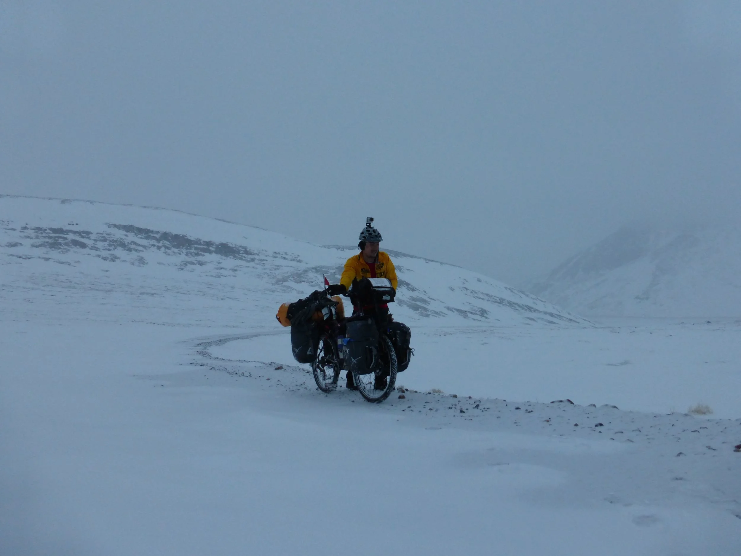
Old Crow. Yukon.
Ever since I heard that a temporary winter road, one that is constructed maybe once every 10 years was open in the spring I wanted to cycle it. A motorcyclist had been turned back at kilometer 100 but with the recent warm weather and the snowstorm my hopes of going there had been crushed.
Then Old Crow came to me. Earl lives in that small community of 300 people and had flown to Inuvik, then rented a truck.
"It's nice to get out once in a while."
My last river crossing
Earl from Old Crow
"It's all like that from here." -Paul said, while sloping his palm upward. Over the next two days I will climb two mountain passes in the Richardsons mountains and enter Yukon.
Looking back
The foothills of the Richardsons
Panoramic view of the road behind me
Finally the mountains
Snow was in the forecast. I didn't bother to look how much, it wouldn't matter. Today I was going up the mountains.
I had ridden the Dempster going North last summer. Its funny how you don't recall the downhills as much as the uphills. It was a long ride up. At points I thought I was at the top and felt disappointed that it was too easy. Headwind blowing snow into my face, mud on the road and steep grades accompanied my final ascent.
Up ahead, the road fades into a snowy abyss. I stop and take breaks, take pictures and take deep breaths. Where will I camp tonight?
Behind me, steep descent down the valley
Beside me, steep peaks engulfed in clouds
At the pass
And then I make it to the pass. I'm tired. It's 10pm, it's getting cold and the snow is still falling.
I look up, there is a radio tower on the summit. I wanted to climb that last year I was here. The steep road leading to it is blown over with snow.
It's impossible
The faint outline of the radiotower up on the left
The snowed in road.
"Impossible? How do you know that unless you try."
Up ahead there is the slightest outline of the edge of the road.
with that in mind, I tried lifting my loaded bike onto the bank. Nope. Had to go around it.
Both me and my bike sink into the snow. Bikes are not designed to be pushed in deep snow. Sometimes its so bad I need to lift the front wheel, sometimes I lift the whole bike and stop to catch my breath after every step.
I often stop, look back and look up. Then I look down, knee deep in snow. Lift my bike up and move it forward one step. Then I stop again. "WTF am I doing?"
The edge of the road helped a lot, still hard work but you aren't deep in snow.
It wasn't warm, but going up takes so much effort, I was soaking wet.
There was solid ground now, but there were still sections that were blown in with deep snow.
It took me two and a half hours to get up here. It was 12:30am. The good thing about being so far north is the long days.
I made it to the top. Now what?
I found some cover from the wind between the two buildings for the radio tower. Melted some snow for water and wondered if I should camp in here, sheltered from the wind and snow or go some 100 meters out and sit on top of the peak.
I chose the latter
DAY 7: Fort McPherson to A mountain peak (~60km)
At night I could hear the radiotower generators running in the distance, the wind blowing and the snow hitting my tent.
But in the morning, I was reminded why things like these are worth doing.
The sky was clear and the snowy peaks of the Richardsons as beautiful as ever. Behind me I could see the Mackenzie delta in the distance, and ahead the mighty Dempster Highway winding across the mountains to Yukon.
I debated staying here for a day, but it was time to go. There is still much to see of the Dempster and with another mountain pass awaiting me, noon was already a late start.

Looking north, where I spent last week on ice roads, in storms and with the kindest people I have ever met.
With few brief interruptions, I was able to go down on the bike, the low nightly temperatures had frozen most of the snow.
Below is a short video of riding down from the peak
When I hitched a ride north, I saw this winter wonderland through the window of a truck. But this was different. Unreal, beautiful, peaceful...
I wish I could describe it in words, but I can't.
Instead I will let the pictures talk for the next 25km.
The elusive snowbird, Tarmigan
The road
August 2013
April 2014
I wondered what that is. It's small stones that fall off or get blown by cars/trucks. Then they sit on top of the snow and get moved (rolled) by the wind in different directions, creating these interesting formations
There it is, I see it.