Antelope Wells port of entry.
Chihuahua, Mexico.
October 18, 2015
A complete opposite to the pavement to Antelope Wells, my first ride in Mexico is on a dirt road and... in the wrong direction. But I didn't find that out until 12km later when the road ended at a ranch.
No alternatives to the narrow busy roads for the first few days. Full of trucks but surprisingly all were nice. Some drivers would come to a complete stop behind you, if there is opposing traffic.
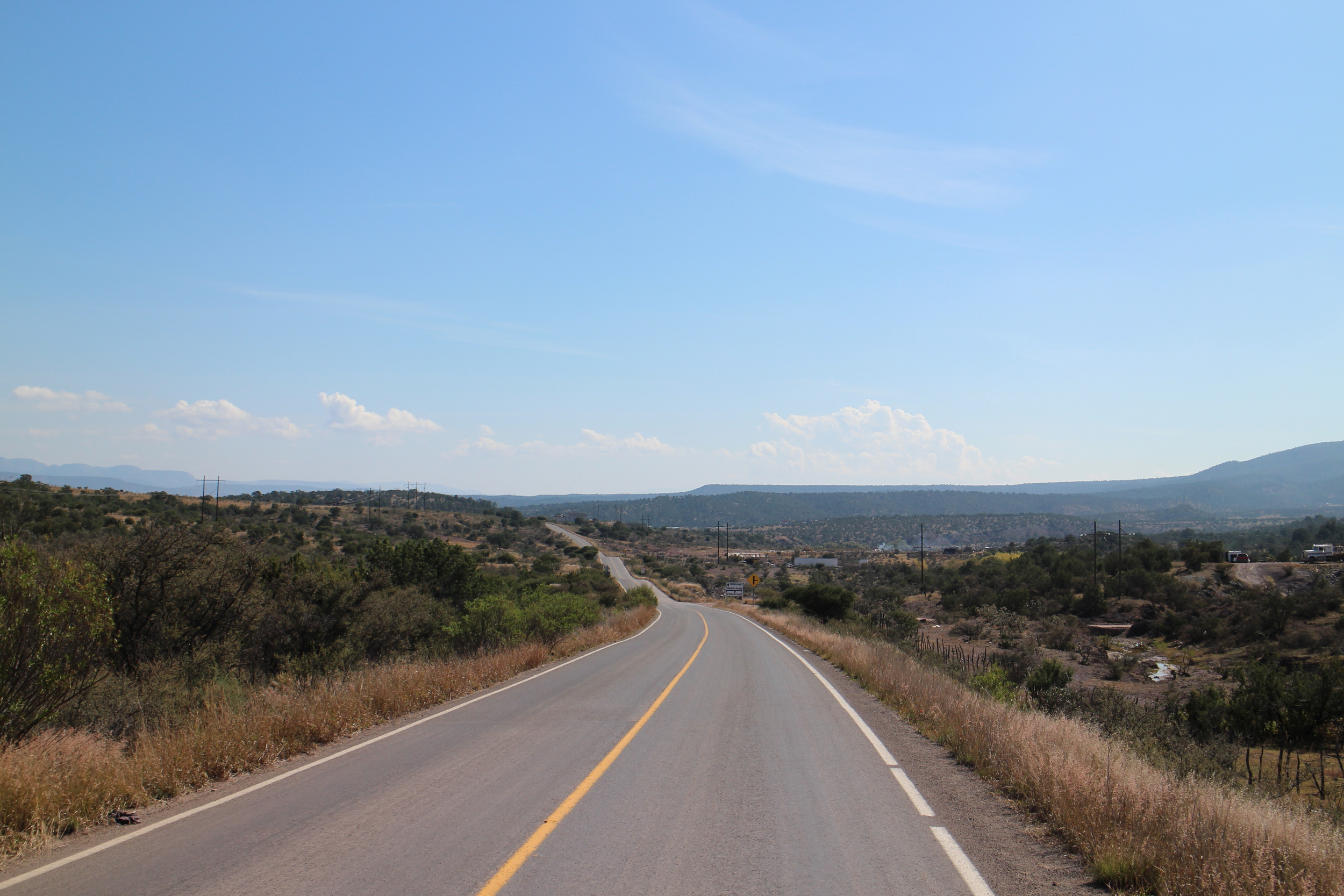
It wasn't until after Nuevos Casas Grandes that the fun began, an empty wide road makes you feel like you are riding on an airstrip.
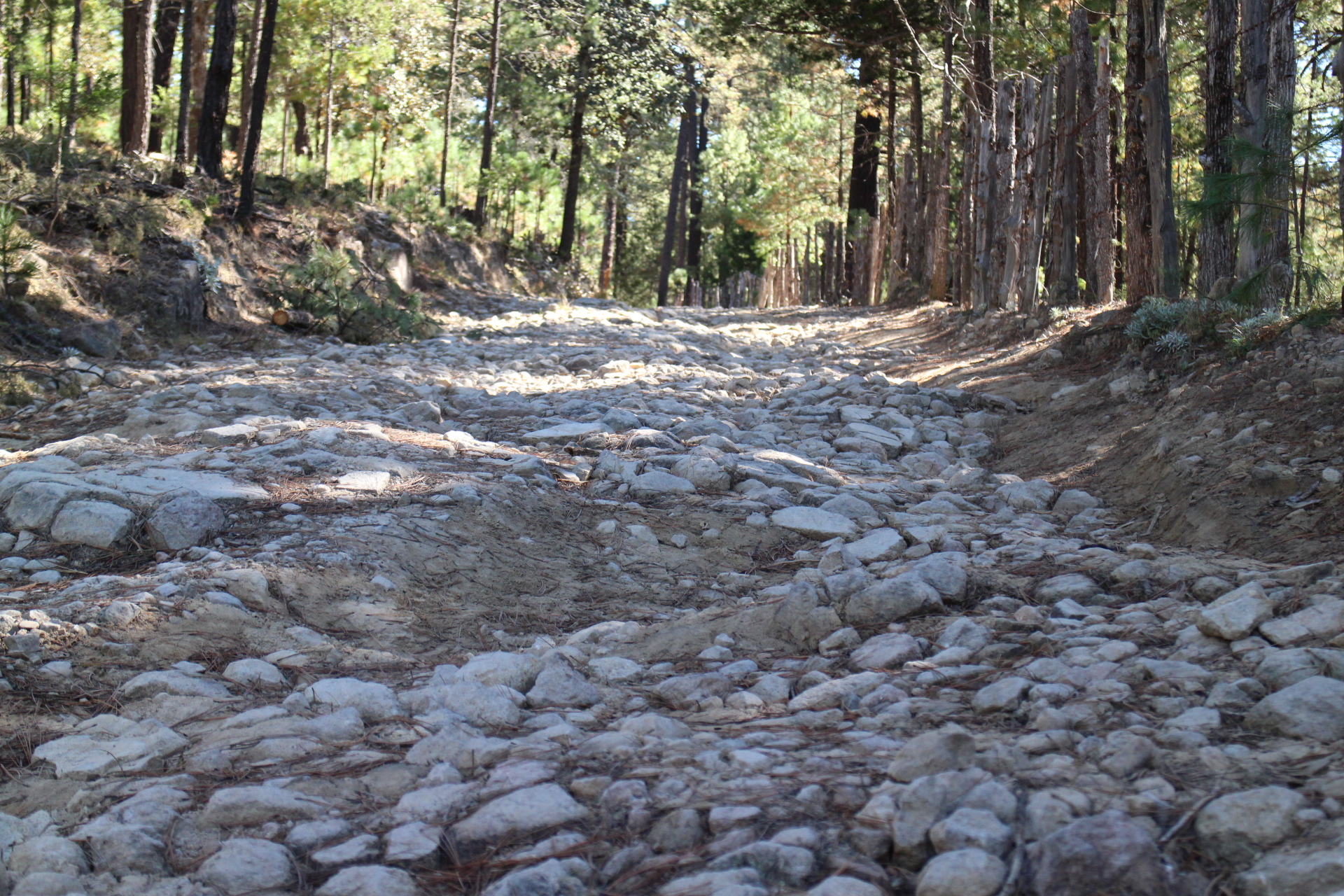
And then the real fun - dirt roads.
Although parts of it felt like aquatic touring. Never underestimate the depth of these puddles...
Even if you are in a car...
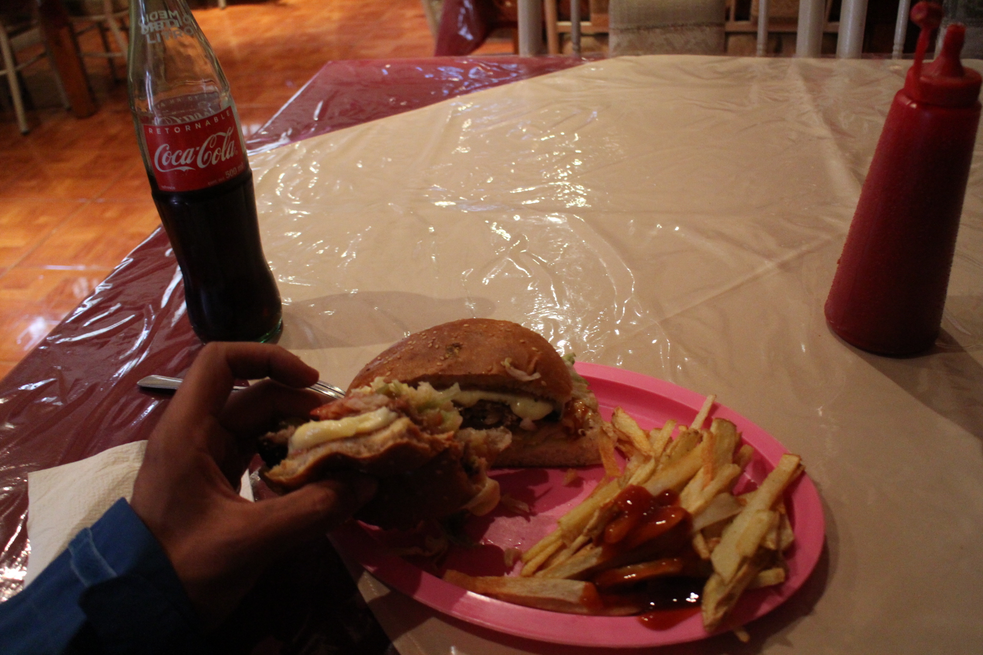
It's been four days since I entered Mexico but it didn't feel like I did until now. I am sitting in a small restaurant with two burgers and a glass bottle of coke in front of me. Women are watching a spanish soap opera on TV and kids are playing on the console games several feet from me, that reminds me so much of my childhood - running to the consoles after school to spend all our money on Street Fighter. One of them comes to me and asks if I have change for 2 Pesos but by the time I realize what he was asking, he is gone. Now the TV shows a 2 minute ad about some slippers, then comes a scene where a man from a ladder drops an egg into one slipper, a woman picks up the egg and breaks it into a bowl... they never show what happens to the egg.
I look around the room and everybody is watching me, I don't know any spanish. All I can do is nod and smile.
Littering is a big deal here. I'd stop to admire some horses on the loose beside the road and have this perfect moment broken by the horse stepping on a plastic bottle.
While hurricane Patricia is doing some damage on the east coast, all I seem to get is headwind. Not too happy.
Here is the typical "Mexico" truck, they haul anything, supplies, logs, cars and people. And they all kind of seem... unsafe!
I decided to head over to a dead-end (according to the map) town in hopes of finding a thru road and avoiding the bigger highways. A man told me there is a way across, and was very happy to meet me, eventhough we barely understood eachother.
Road construction in progress. Real dusty
As I got into Cocomorachic, I asked directions for Tosonachic. Oddly, somebody pointed back to the way I came from...
Then I asked few more people and it seemed that half send me one way and the other half another. What is going on?
The town I came from is called Tonosachic... and I'm headed to Tosanachic, or it was the other way around. I headed south just in time for the sunset.
The roads got rougher and more remote. Until noon, I had seen more bridges than cars (1). Looked like rain but it never did. Granny gear up another hill.
People here in Mexico have found a sustainable eco friendly way to make powerlines.
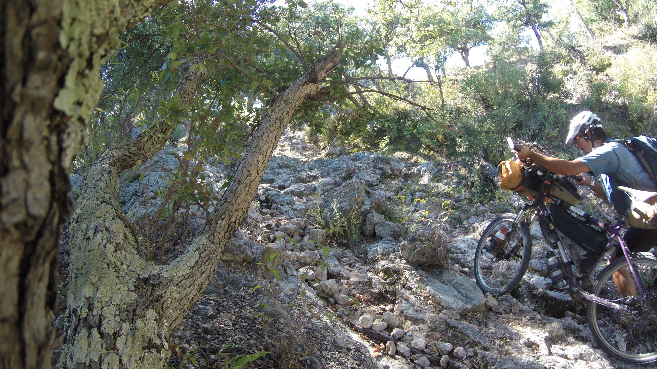
Steeper and rockier, it was amazing country in the Sierra Madares, at times I wonder how many people have cycled here. I think I am seeing bike tracks in the mud but its hard to tell. There was no flat ground today, aside for a small stretch in town... even my camp spot is slightly off level.
I rode into the next town in the morning to ask for directions. It hasn't been very promisng as few people told me the only way to the highway is back through Las Varas. The family I spoke to invited me for breakfast. Tortillas and eggs, rice and powdered milk in hot water. I remember eating the latter way back in Bulgaria but I cant remember it's name. We manage to ask eachother few questions via a dictionary but best of all, the man takes me outside, points to the mountain and tells me there is a way to the highway.
Wouldn't be fair to leave town without a coke. When I went into the small store, the woman looked at me and opened the fridge, I didn't have to say anything.
Past the vulture fence and onto the calf road..
It was a real push to get to the top.
Literally...
I get to the highway and replace the quet sound of the wind and the smell of whatever the dirt roads smell like with loud engine brakes and the smell of burning from people coming down.
Few hour later, I am rolling down the main strip at Basasechic, just as old schoolbuses drop off mine workers and then pick up the night shift.
I decided not to do too much touristy stuff but there were waterfalls 10 mins down the road. Pretty hard to refuse.
Finally reached Creel and met up with Wolt, who has been doing the same route as me. He decided to spend an extra day in town but I wanted to get to copper canyon.
Feels kind of disrespectful to ride a gondola up or down the canyon, although there is mtb track! Maybe another time.
Today would be easy, descend to Urique, have lunch and then ride up a little ways to Batopilas. That's before I found that there is an alternative route to Urique. Up until 2pm, everything went fine, good roads, a little pushing and gorgeous views. Then the road became rogher, then it became a stream, then... nothing at all.
I kept trying to follow the road but ended up dead-ending multiple times, sometimes backtracking 50m sometimes 2-3km up and down steep hills. By nightfall I had spent the last 5 hours to cover a mere 5-6km and the worst part - there was no way through so I would have to backtrack tomorrow. There was a road (not on the map) which seemed fairly decent but it goes into a different valley and there is no telling where it leads. Anything is better than turning back. I pitch my tent, start making dinner and an image of a man chiseling ice off of his car as I left town this morning pops in my head. I strain to hear the buzz of a car nearby but only the wind blowing the leaves breaks the silence... and a distant thunder of an automatic gun. Oh yeah... welcome to Mexico!
So, deadend. I backtracked to a bigger road and went to try another route. But he good news is that you don't need a bike stand here.
There was even a store in one of the small towns but thats where the road ended.
Turning back would make sense but i am too stubborn to do that. I kept trying road after road, most of which deadend at somebodys house to find a small one going to the next town.
There, after crossing a fence and up over some boulders there was a hiking trail. I went to scout it and it didnt look too good but a man hiking it said there was a way trough to the next town. I guess thats how this works, town by town. So i started pushing my bike.
After some trail-less wandering in the forest, i found some road which led to a ranch. The people there showed me the trail i had to take and assured me there was a way to urique... but it was not easy.
Thats all i needed to know!
Walking my bike down the trail, sometimes pedaling and almost always pushing uphill. When i reached the high point i thought it was over.
It took over 3 hours to descend the switchbacks, narrow trail my right leg getting scratched by thorny plants and my left hit by the pedal. It wasnt pretty. Well, it kinda was.

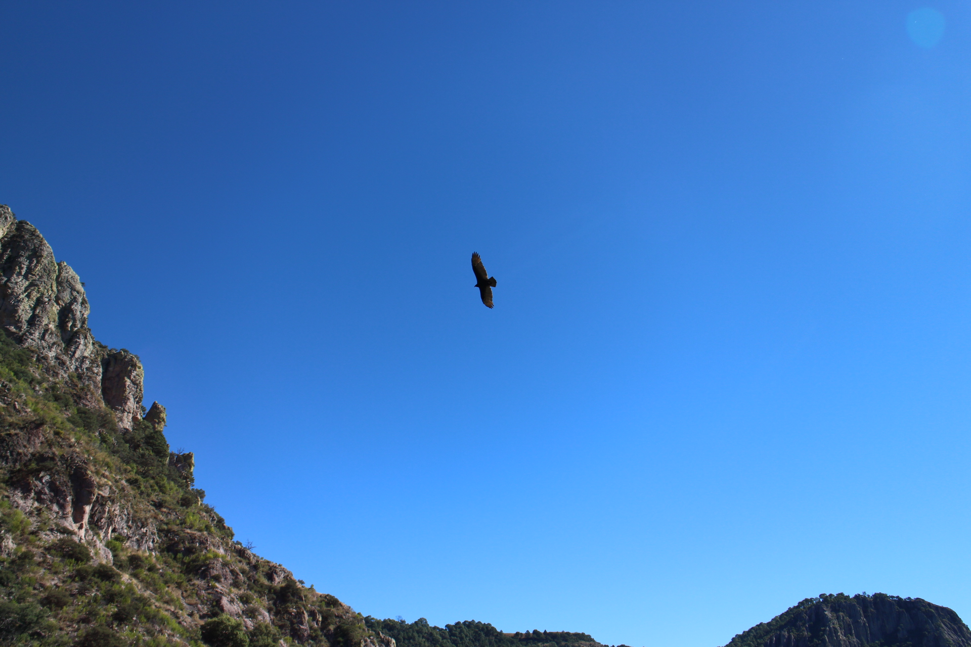
Mostly downhill to Urique. I expect major neck problems tomorrow either from looking up at canyon walls or at birds
Unfortunately there was no bank in Urique. I bought some food and headed out. It was nearly impossible to find decent camping up the switchbacks. I set up beside the road only to realize that I've been holding traffic. The cows watched me as I ate breakfast, packed up and when I went their way, they scrambled to the hillsides.

Truth be told, there was barely any pedalling going up. The sign to Batopilas was shot up but the views were as good as ever.

To most dogs in Mexico, a touring cyclist is a piece of meat. They want to bite you, eat you and maybe even kill you! Best defence is to stop and speak to them in English - that gets them real confused and they forget why they were chasing you in the first place.
This little fellow escorted me trough a small village, circling me and protecting me from the other dogs.

With Batopilas still few hours away, I set up near the road. Cars seen today: 0. Distance in a straight line from yesterday: about 10km. Sunset: check.


Nothing wakes you up in the morning like an hour and a half rough descent from 2100 to 600m.

Breaking the cow-human barrier for the first time in Mexico. Cows are not just for chocolate milk, cheese and burgers! They like to scratch on fences, moo at strangers and have a fine taste for any and all grass.

No bank in Batopilas ether. This leaves me with 80 pesos until I find a town with one. But thats not what worried me.
I was riding across town for the second time, looking for the store which has bike tubes, the people carrying guns at the plaza drove up to me and asked to look at my camera. Quickly I was surrounded and they were checking if I had any images of them. When I deleted few of the photos of Batopilas they seemed content and left. Be wary of having a camera out in these areas...
So I headed out as fast as I could, no luck with camping - another night on a swithback, few trucks passed during the night. One stopped and somebody said something in Spanish and then drove off.

One day to Morelos, where I was told there was a bank but it was closed. I spent my last money on food and told the hotel owner that I can pay tomorrow (now consider that I do not know a word in spanish - there was a lot of nodding and waving, haha).
Well... it wasn't a bank but a telegraph. No money for me. The banker was kind enough to pay my room, which leaves me with few potatoes, a bit of rice and pasta and I don't know how long until next town with a bank.

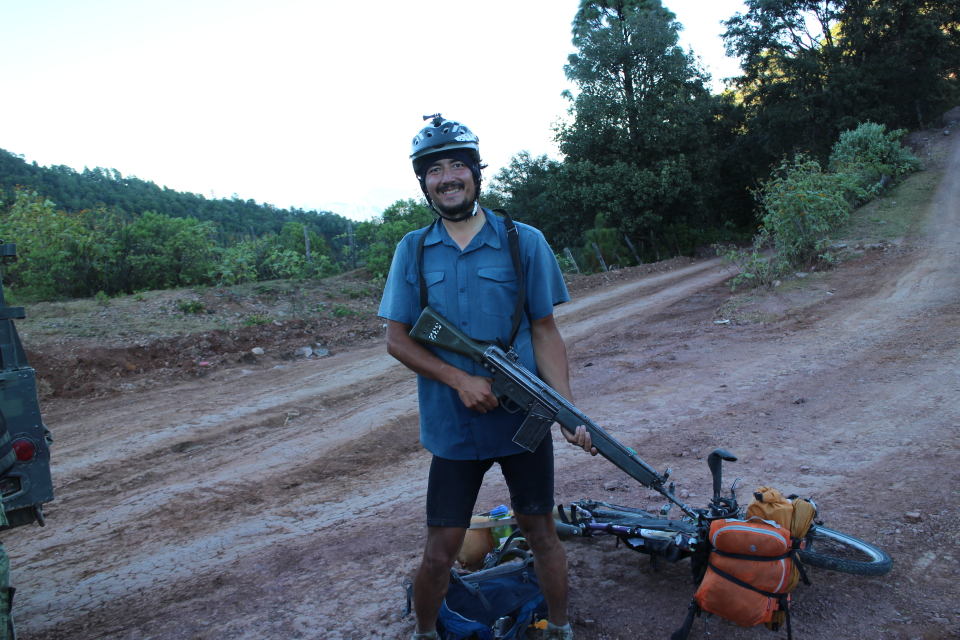
While going up a hill, the army pulls over. I think they are offering me a ride, I do not object. We trow the bike on the back and... they offer me beer. One of them spoke a little english.
"It's difficult here."
"Yeah... all those hills are crazy," I say and start waving my arms, illustrating switchbacks and hills.
"No, its dangerous."
"Ah..."
"What are you going to do when they rob your passport?"
Oh....

Then I figured it out. I take one of those to seem like a local, since everybody had guns in Batopilas :)
Found a decent campspot down a spur road, looks like there have been lots of stems here?

And while setting up my tent, I found out why. Marijuana. Oh... just another day in Mexico. I hope those guys who worked here don't come back tonight.

It appears that all trucks come here to die off. I have not seen a passenger car since Creel and these are the kind of roads that in the USA would be considered "sport" jeep trails, and people would drive atv's, etc. Here, it's the only way to get around and ship supplies.

Navigation is tough, most of these roads are not on any maps. Lots of turn offs but following the most used road normally works. At many intersections there are houses, so that I can ask for directions. And with my spanish, that means saying the name of the town and pointing down the road. It's a miracle I havent gotten lost!
Baborigame: no bank.

No bank in Guadalupe either. I have now, twice asked people for food and both times I was fed, people from the village would gather around the bike, ask questions, inspect every part of the bike and pick it up to see how heavy it is. Maybe running out of money is one of the best things that has happened to me.

Before leaving, a man stopped for a chat. He is from the local bike club. He took me to his uncle's store and loaded me up with supplies. As I rode up the hill out of town - Emanuel joined me on his bike.

At the top of the hill, he invited me to stay in town (he could drive me back here tomorrow). Considering my diet for the last few days, it was hard to say no.
One of the members of the bike club spoke English. He moved here from California 3 years ago. When I asked him which place he liked more, he says California. Hats are cheaper there.

A day later I am riding in the wrong direction and I know it but I keep going. The locals tell me there is no way to Durango from here and point me where I came from. A truck driver draws me a map, the road does not look promising but if he doesn't know the route, who would?
One more day. I finally get to some real valleys. Not flat by all means but both road surface and grades are reasonable.

I set up camp at 2900m. Its November and really, really cold.

Next day I almost find out the answer to one of life's greatest mysteries.
Why did the chicken cross the road?

Cattle guards make the ride down very exciting.
And I am finally out of the high mesas and ridges and heading to Guanacevi.

Guanacevi, which has an ATM.
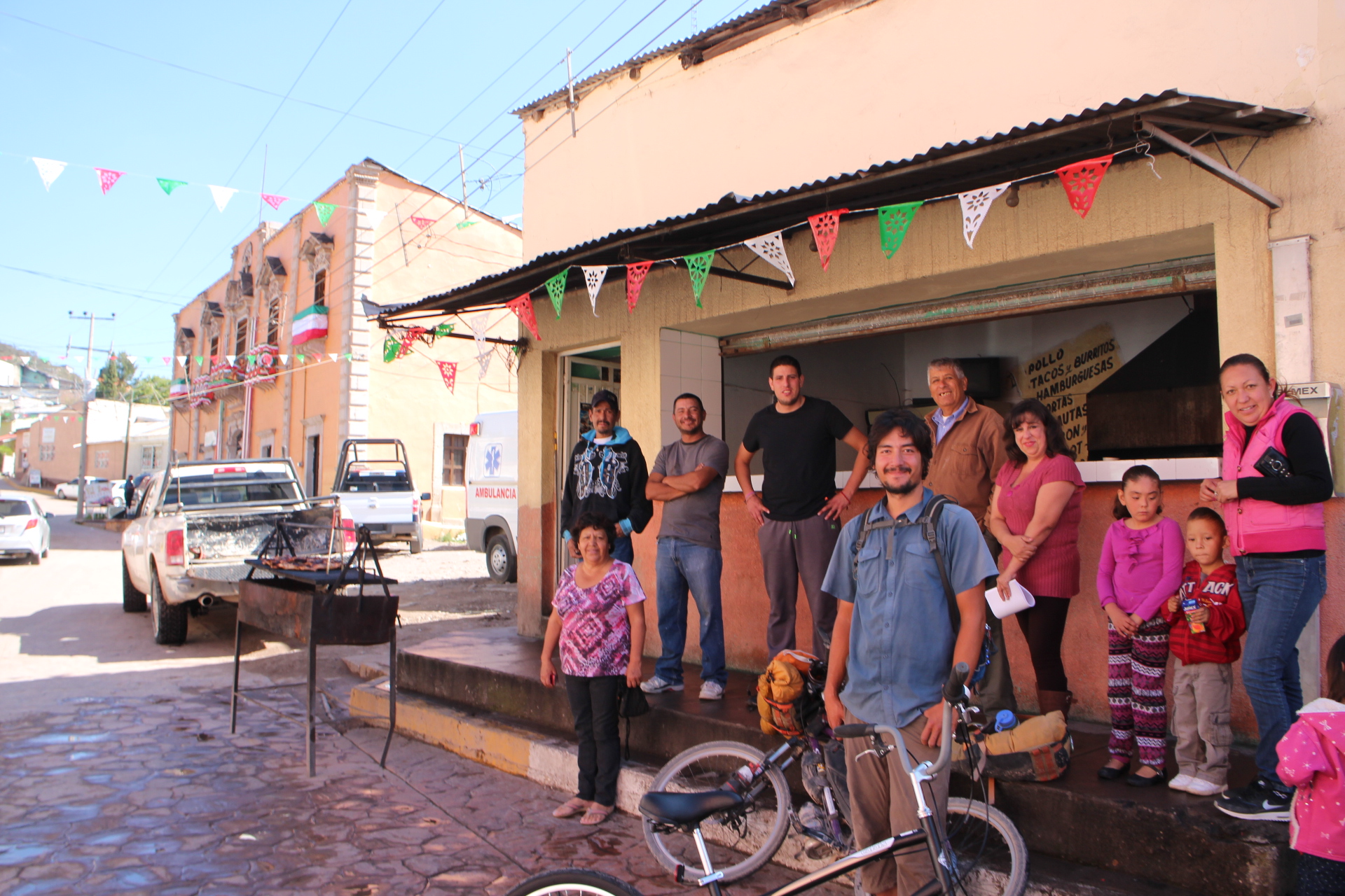
Guanacevi, where after this burger, I proceed to eat so much food and candy that it can make an adult sick, send a kid to the hospital and very likely kill a small animal!
The following day I stop by a food stand to grab a burger. People quickly surround me to see where I come from and where I am going. By the time I am ready, somebody had already paid for my food, a man is coming with a bottle of coke and a bag of food, a kid brings me doughnuts and two of the guys join me on their bikes to ride out of town.
Hm. I think I love Mexico.
And for the first time in two weeks.
PAVEMENT.